Showing posts with label 3 Sisters Bridge. Show all posts

Friday, May 14, 2010

JFK Administration D.C. Freeway System- Other Aspects


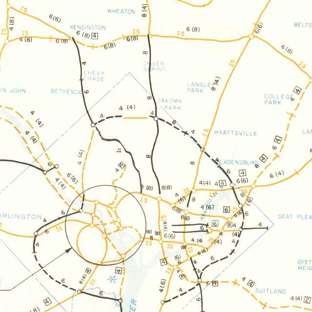
A down sized, down scaled highway system


JFK Administration- November 1, 1962

It eliminated the high capacity (8 lane) cross town I-66 North Leg in a new swath alongside Florida Avenue and U Street, replacing said with a 4 lane depressed express street beneath Florida Avenue, ascending to grade at U Street though with depressed underpasses.

It eliminated the high capacity East Leg of the Inner Loop alongside 11th Street NE/SE, effectively replacing it with a spur along Eastern Avenue NE to the I-95 Northeastern Freeway.

It eliminated the Three Sisters Bridge

at page 25:
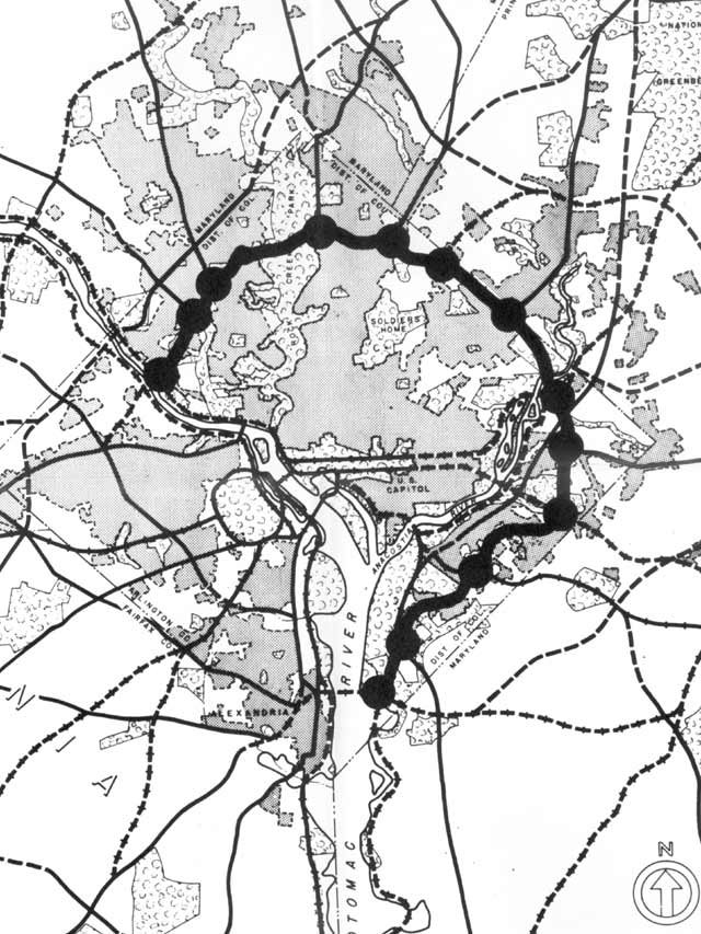
In the 1959 plan, Three Sisters Bridge was part of an intermediate loop (located between the Capital Beltway and the proposed inner loop) that virtually circled the city. The Agency's studies show no need for the portion of the intermediate loop between the Potomac Rover and The Soldiers Home area. Standing alone, the only purpose of Three Sisters would be to bring trucks and additional auto traffic from Fairfax and Arlington Counties into downtown. For that purpose the bridge is not required.

As of 1957, there were a total of 22 bridge lanes across the Potomac. Projects now under construction, or recently completed, will nearly double the number of lanes, as the following table shows:

The above table does not include the Old Highway Bridge, though the Virginia Department of Highways proposes that the bridge be used with reversible lanes. This would add still another two lanes in each direction for peak traffic.

The Agency proposes two rail rapid transit lines to Virginia, one of which would serve the Three Sisters Bridge corridor. Rapid transit service would not have have been provided in this corridor under the 1959 plan. With such service available, in 1980 a total of over 30,000 people - many of whom would otherwise be using their autos -- would use public transportation from Virginia into the District in the morning peak hour. This is 18,000 more people than use such transportation today, enough to fill 12 bridge lanes. Figure 14 shows the difference in growth of vehicular traffic across the Potomac and compares that with present traffic needs.

The result, as the following table shows, is that under the plan recommended by the Agency, central bridge capacity will be adequate for the needs of motorists in 1980 without Three Sisters Bridge.

This letter of John F. Kennedy illustrates a further evolution of his administration's freeway plans for Washington, D.C.
“…I noted that certain portions of the highway network within the District of Columbia required further study. The guidelines which I believe should be followed in this re-examination are as follows:
The re-examination should focus upon the sections of the highway plans which have from the beginning been the most uncertain and the most controversial- the North Leg of the Inner Loop and the Three Sisters Bridge, both of which involve the manner in which necessarily involve a re-study of those additional portions of the plan which are directly affected by the conclusions reached in the re-examination…”
“ the very large part of the highway program which is not under study can go forward as scheduled.”- John F. Kennedy letter June 1, 1963
Notably the June 1, 1963 JFK letter has him discuss the I-66 North Leg and the [I-266] Three Sisters Bridge as controversial and in need of further study.

Since his Administration’s November 1, 1962 report had down-scaled the former while unequivocally excluding the latter altogether, his June 1, 1963 letter can be taken to suggest that JFK had become receptive to considering some sort of road alternative to the previous North leg proposals, and to the Three Sisters Bridge in some form as parts of the future Washington, D.C. road network.
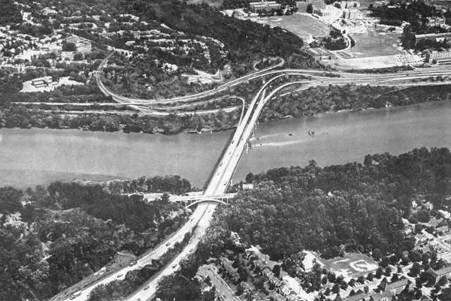
Proposed I-266 Three Sisters Bridge between Virginia and Washington, D.C.
pointing at Georgetown University


Sunday, December 28, 2008

Who Really Stopped Washington, D.C.'s Freeways

From Zachary Schrag
http://www.washingtonpost.com/wp-srv/liveonline/00/magazine/levey112700.htm

Washington, D.C.: I enjoyed the article, especially the profiles of Booker and Abbott. But let's not forget who really stopped Natcher's attempt to force the city to accept the freeways.

While the ECTC was gathering a few dozen people to march on picket lines and disrupt hearings, Congressman Robert Giaimo of Connecticut was gathering votes in the House of Representatives to release subway funds from Natcher's control. Thanks to his efforts, on Dec. 2, 1971, the full House voted 195 to 174 to release the D.C. share of Metro funds without forcing the city to build the Three Sisters Bridge. Following this defeat, a very rare case of the full House overruling an appropriations subcommittee chairman, Natcher never again seriously threatened Metro. And without that threat, the D.C. government had no reason to build the freeways.

Essentially there were three challenges to the freeways: in the streets by the ECTC, in the courts by Peter Craig (and his pro bono counsel, Roberts Owen), and in Congress by Robert Giaimo. Craig and Owen bought time, and Giaimo stopped Congress's blackmail. The ECTC, however noisy, did relatively little to change the minds of people in power. Radical protest can make a difference, but in this case the real victory was won by people working within the system.

Zachary Schrag
Columbia University


Proposed I-266 Three Sisters Bridge
looking from Virginia to Washington, D.C.
with Georgetown University at upper right.

... Peter Craig, a junior lawyer at the prestigious firm of Covington & Burling. Craig had come to Washington after graduating from Yale Law School in 1953.

In September 1966, following the N.C.P.C. vote, the Committee of 100 resolved to file a law lawsuit against the D.C. government and the N.C.P.C. to block [3 Sisters] bridge construction. Peter Craig, acting for the committee, turned to his former law firm, Covington & Burling. Partner Gerhard Gesell agreed to take the case for a nominal retainer and assigned lawyers Roberts Owen and Gerald Norton to the matter. Owen, the lead counsel, had paid little attention to the highway fight, but he enjoyed suing the government to force it to obey the law.

p 41 and 125 The Great Society Subway by Zachary M. Schrag


   Proposed I-95 B&O North Central Freeway next to Catholic University of America


Covington & Burling


Read About the Committee of 100's opposition to US NCPC's Extending the Legacy

Committee of 100 Ruminations


Frederic Delano 'Family' : U.S. NCPC, Committee of 100, and Covington & Burling


Subverting the North Central Freeway

Physical Realities Undermining the North Central Freeway

A Sampling Of Attitudes Towards D.C. I-95

Sunday, March 18, 2007

Georgetown's Waterfront Freeway Corridor & Connections

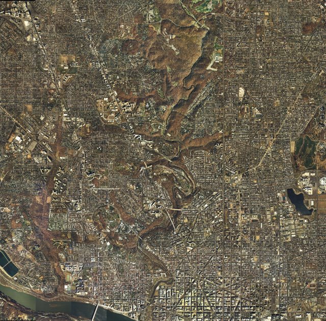
Georgetown Waterfront, Glover-Archibold Park, and portion of Canal Road
Image produced by National Capital Planning Commission for the Washington Geographic Information System. Distributed by VARGIS LLC of Herndon, VA.
This consists of the Whitehurst Freeway along the downtown Georgetown waterfront to K Street, and its various proposed upgrades and extensions proposed to go to the north, northwest:, and west: aka, the Glover-Archibold Parkway, the George Washington Memorial Parkway (to Maryland's Clara Barton Parkway and the I-495 Capital Beltway); and the Three Sisters Bridge.

Generally, the focus is solely upon the Whitehurst, despite its short length and its disconnect with the freeway system symbolized by its northern ending in the vicinity of the staircase near Georgetown University famous to many people for its appearance in the1973 movie "The Exorcist."
The Whitehurst Freeway:

Built late 1940s, prior to the 1956 U.S. Interstate Highway Act, hence the Whitehurst is built to a lower standard of design relative to the later highways designed as interstates.

According to Steve Anderson's Whitehurst Freeway entry in D.C. Roads:
H.C. Whitehurst, who was director of the District Highway Department, conceived the skyway that eventually bore his name. He designed the K Street Skyway as the first piece of a long-range, district-wide plan to build freeways through Washington and its neighboring suburbs. Whitehurst, who was an early booster of the Interstate highway system as chairman of the American Road and Transportation Builders Association (ARTBA), died while the freeway was under construction. The Whitehurst Freeway was named for the former highway chief after his death.

The District awarded the construction contract to Archibald Alexander, a pioneering black engineer who worked his way up at Marsh Engineering on projects such as the Tidal Basin Bridge and seawall during the 1910's and 1920's. Alexander eventually founded his own firm specializing in bridge design and construction, which carried out the contract.

ALONG THE POTOMAC, WASHINGTON'S FIRST FREEWAY GOES UP: The Whitehurst Freeway was built to what were contemporary standards in the 1940's, but far short of Interstate standards. The four-lane freeway was built without shoulders and had a design speed of only 30 MPH. Exit ramps also were of substandard design. Because the freeway was to be built directly above K Street, very little demolition work was necessary. However, there was one notable exception - the home of Francis Scott Key, the author of the poem that became the Star-Spangled Banner - that was torn down for the western terminus of the freeway.
The corridor is subsequently considered to be upgraded and extended to interstate highway specifications in a number of studies, including the1957 North West Freeway study "A Report of the study on the location of Interstate U.S. Route 240 Washington, D.C. which considered 3 options of which a portion would utilize this corridor:


Route A: Palisades trolley alignment to Inner Loop via expanded elevated Whitehurst Freeway: 4.57 miles
Route A-2: variant of Route A Palisades trolley alignment with narrower footprint north of ChainBridge to Inner Loop via an expanded elevated Whitehurst Freeway: 4.57 miles
Route C: Wisconsin Avenue corridor to Glover Archbold Park to Inner Loop via expanded elevated Whitehurst Freeway: 5.65 miles
The subsequent 1959 North West Freeway proposal had a separate inland connection to the Inner Loop for I-70S to supplement a Glover Archibold Parkway: both if which were effectively canceled by 1962.

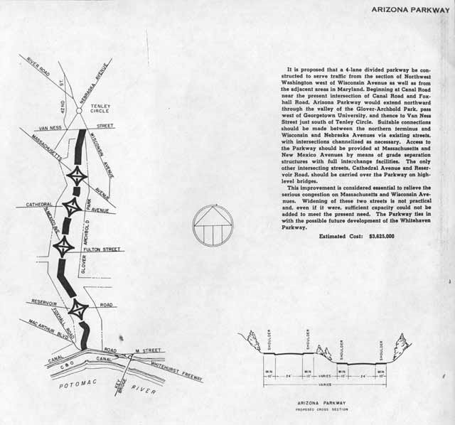
The Glover-Archibold Parkway

This appears in 1952, as a parkway that would not allow trucks.
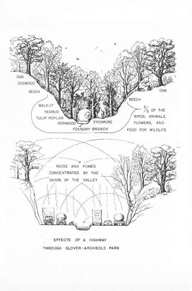
The 1957 North West Freeway study includes the option of an interstate highway version to connect to an interchange at the foot of Glover-Archibold Park next to Georgetown University with an expanded extended Whitehurst Freeway.
Illustrations from 1957 publication "Should Glover-Archibold Park Be Destroyed"

1959 Mass Transportation Plan
The 1959 Mass Transportation Plan has the Glover-Archibold Parkway serve as both a radial to and from I-70S at a split to the south of Tenley Circle, and as a segment of the circumferential Fort Drive Intermediate Beltway.
1939 Fort Drive
The Clara Barton/George Washington Memorial/Canal Road Parkway
The George Washington Memorial Parkway was planned to run along both sides of the Potomac River to and from the I-495 Capital Beltway, yet was completed only on the Virginia side.
The segment in Maryland connecting to the Capital Beltway was constructed continuously with 2 lanes in each direction to a point where it transitions to a single 2 lane roadway, and then to a brief 4 lane divided segment before again reverting to a single lane in each direction near the Maryland/District line.
The Three Sisters Bridge
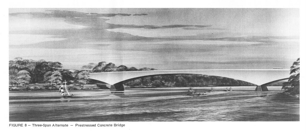
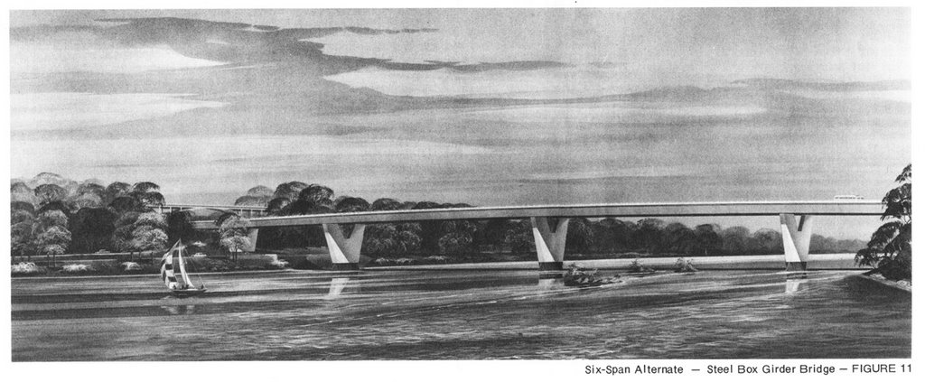
This bridge, named for the trio of rocks in the river, would have connected Virginia and Washington, D.C. respectively at the foot of Spout Run and Glover-Archibold Park. It appears in the 1959 Mass Transportation Plan. As an extension from the Glover-Archibold Parkway that would connect to inside the beltway I-70S at a split to the south of Tenley Circle, it would serve to facilitate traffic from I-70S and the circumferential Fort Drive Intermediate Beltway to and from Virginia.

It disappears, along with the Glover-Archibold Parkway and the entire NW segment of the Intermediate Loop in the Administration of U.S. President John F. Kennedy's November 1, 1962 "Recommendations for Transportation in the National Capital Region; A Report to the President for transmittal to Congress by the National Capital Transportation Agency."

The Three Sisters Bridge would subsequently reappear as part of an I-266 project connecting I-66 in Virginia and Washington, D.C.
It had more then one study.

Proposed I-266 Three Sisters Bridge looking from Virginia to Washington, D.C. with Georgetown University at upper right.

The plans from the 1950s would have had an inland continuation of a Glover-Archibold Parkway. via that swath of green of Glover-Archibold Park to the left of Georgetown University.

Under such plans, the Glover-Archibold Parkway and the Three Sisters Bridge were to be a part of Washington, D.C.'s Intermediate Beltway/ Fort Drive Parkway.


From Scott Kozel's Roads to the Future:
A construction contract was begun in 1972 for the Three Sisters Bridge substructure, but the contract was suspended by a court injunction several months later, and then cancelled a few months later by DC DPW. That happened at the same time that a court injunction stopped the design process on the I-66 extension in Virginia from the I-495 Capital Beltway to the Theodore Roosevelt Bridge. The design process for I-266 never restarted, while a revised 4-lane version of I-66 was placed under construction in 1977 and opened in 1982. Details are on my I-66 article Interstate 66 and Metrorail Vienna Route. See Mike Hale's article Interstate 266 Unbuilt.


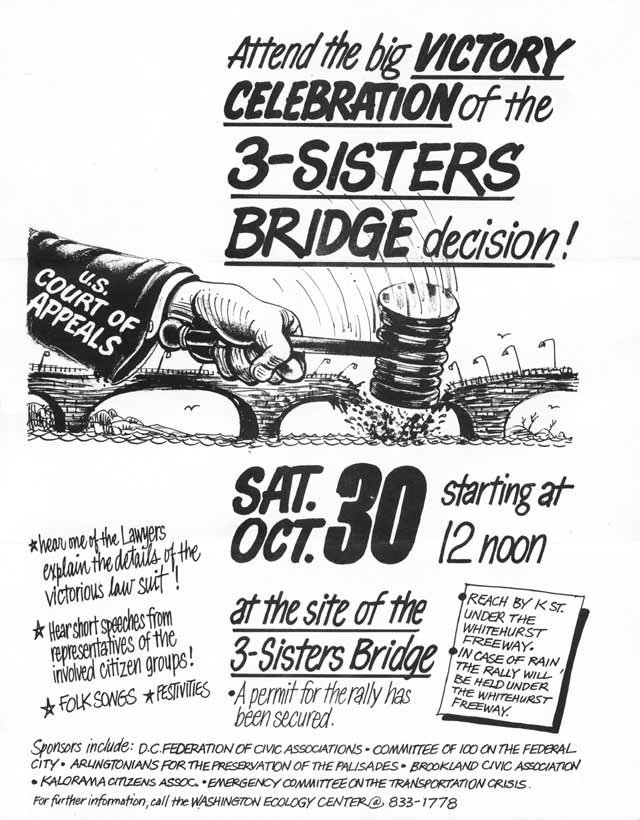
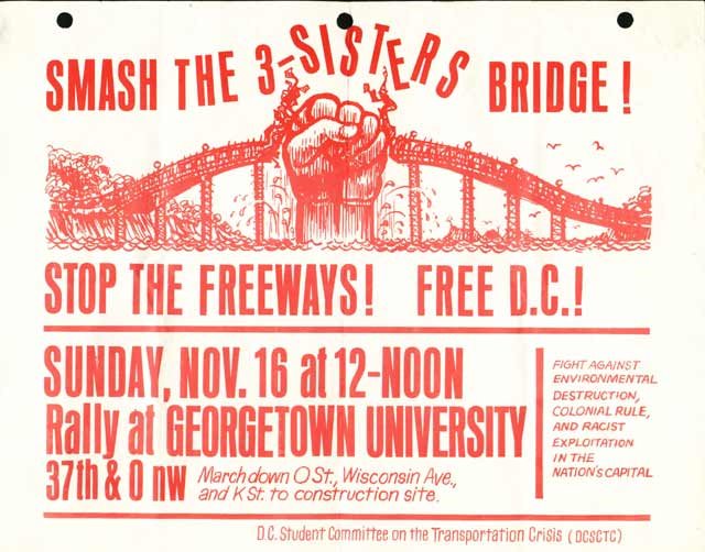
The Three Sisters Bridge became colorfully protested, with protesters that camped out on the three sisters to thwart the construction.

The law suit would be handled by Covington & Burling, which later sued against a 12 lane Woodrow Wilson Bridge (and in other suits, against the North Central Freeway, the East Leg to East Capitol Street, and the later Barney Circle Connector), with the assistance at various times with the Georgetown Law Center (Georgetown University Law School), and the D.C. Sierra Club.