Showing posts with label North Leg. Show all posts

Wednesday, November 11, 2015

Modify WMATA Farragut Connector Tunnel To Accomodate K Street Tunnel For Crosstown I-66


Years ago, during the 1960s, the idea of a vehicular tunnel beneath K Street was advocated as the best way for achieving the crosstown D.C. link for I-66.  It was promoted by opponents to the previous plan from the 1955 Inner Loop study for a new right of way swath freeway along the southern edge of Florida Avenues and U Street, requiring removing hundreds of buildings; the K Street tunnel meanwhile would have removed only a relative handful at its eastern connection, largely to clear the Carnegie Library at Franklin Square.

As such, the I-66 K Street Tunnel and had the support of US NCPC's Elizabeth Rowe, who was also connected with the private organization, the Committee of 100 on the Federal City that had been founded by Delano during the 1920s..


Planning for the WMATA rail subway system had accommodated that with space above the southern end of the Farragut North subway station platform.  The need for this connection was initially created by a decision to provide two separate stations for Farragut North and West, rather than a consolidated facility accommodating both station-stops, to avoid excavating beneath the Farragut Square park just south of K Street that would have required removing a number of trees.


During the mid 1970s, the I-66 K Street Tunnel would be 'de-mapped' to scavenge its funds for speeding construction of the WMATA rail subway system, with such reasoning that the world was going to run out of petro by the 1990s hence somehow rendering private automobiles obsolete, and that Virginia was not going to build their connecting inside the Beltway segment of I-66- both which proved to be false.

Subsequent planning following the 1970s 'de-mapping' of the I-66 K Street Tunnel now fails to respect its underground right of way space, and thus needs modification for such.

A recent article in Greater Greater Washington details the two main design options now/recently under formal consideration, with an estimated total monetary construction cost of $130 million.  See official report.

Option One places a staircase from the proposed connector tunnel to the platform below in the way.

Option Two places a new connecting section from the proposed connector tunnel to the existing mezzanine platform.

As it is the area of the southern platform of the Farragut North station that would be connected to the new pedestrian tunnel at the area beneath K Street, this existing area would need an extension to just south of K Street in order to provide the space for this connect that would avoid the space beneath K Street and hence accommodate both this new underground pedestrian connection and the K Street tunnel.   This would have to be a variant of Option One, as a continuous mezzanine level platform conflicts with the space for the K Street tunnel.

A google map photo shows three trees along the Farragut Square park's northern edge, which extends northward past the customary southern edge of the K Street right of way.

Friday, February 27, 2015

JFK Was Re-Considering The 3 Sisters Bridge & North Leg


Recommendations for Transportation in the National Capital Region: A Report to the President for Transmittal to Congress by the National Capital Transportation Agency November 1, 1962

had rejected the 3 Sisters Bridge and North Leg,

yet by mid 1963 JFK was reconsidering these links:


http://wwwtripwithinthebeltway.blogspot.com/2013/11/the-straw-that-broke-camels-back.html

Owing to concerns that the proposed 2x2 'express street would be inadequate, along with abandoning the Crossing at 3 Sisters, a follow-up letter dated June 1, 1963 letter enumerates the cross town I-66 North Leg and Three Sisters Bridge as the most controversial segments require further study
“…I noted that certain portions of the highway network within the District of Columbia required further study. The guidelines which I believe should be followed in this re-examination are as follows:
The re-examination should focus upon the sections of the highway plans which have from the beginning been the most uncertain and the most controversial- the North Leg of the Inner Loop and the Three Sisters Bridge, both of which involve the manner in which necessarily involve a re-study of those additional portions of the plan which are directly affected by the conclusions reached in the re-examination…”
With his November 1962 report having rejected the Three Sisters Bridge, his June 1963 letter calling for that bridge’s ‘re-examination’ meant that it might be needed, hence having JFK place freeways alongside Catholic University of America and Georgetown University.


Canceled B&O D.C. I-95 next to Catholic University of America


The canceled I-266 Three Sisters Bridge- pointing at Georgetown University 

Hence in the months leading up to his assassination, JFK was reconsidering a highway proposal that had been rejected by the November 1, 1962 transportation report, hence placing a second interstate highway next to a major Roman Catholic Church property.

http://wwwtripwithinthebeltway.blogspot.com/2007/02/sampling-of-attitudes-towards-dc-i-95.html


Tuesday, January 13, 2015

Feds Stoked Controversy Over D.C. Freeways By Keeping EARLIER Routes as Official?


U.S. Federal Highway Authority (FHWA) has a web page about the 'de-mapings' of the various freeway systems, including that near and within Washington, D.C.
http://www.fhwa.dot.gov/highwayhistory/data/page05.cfm

Weirdly, that page , shows the earlier routings for the northern portion of the Inner Loop and the 1964 routing for the North Central Freeway (with the 1967 routings for the South Leg and the East Leg).


It completely disregards the extensive evolution of the highly controversial I-66 North Leg routing via the open trench and raised berm along Florida Avenue and U Street being replaced by the I-66 North Leg K Street Tunnel.

The I-66 K Street Tunnel alternative had the later 1960s support of both the D.C. City Council and U.S. NCPC, with the District Department of Public Works being the sole hold out favoring the U Street plan until late 1969 or early 1970.

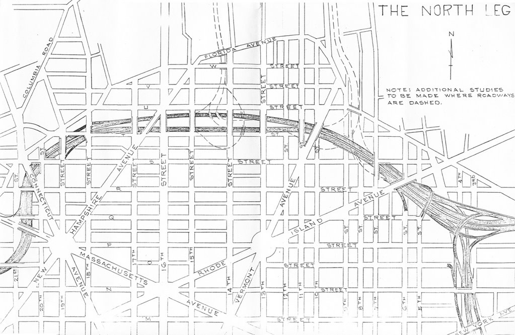
The highly unpopular Open Trench and Raised Embankment Along Florida Avenue and U Street

 The plan initiated by opponents to the Florida Avenue-U Street Plan:
the I-66 K Street tunnel
 
http://www.roadstothefuture.com/DC_Interstate_Fwy.html

The I-66 portion of the North Leg of the Inner Loop would have extended from the present I-66 terminus near the Watergate Apartments at K Street NW, extending as the North Leg under K Street NW in a tunnel, and emerging east of Mount Vernon Square and junctioning with I-95 about a mile north of the U.S. Capitol Building. The I-66 portion of the North Leg would have had 6 lanes. The I-66 K Street Tunnel was the solution to the original I-66 alignment that would have run east-west through urban neighborhoods alongside Florida Avenue NW, and between T and U Streets NW about a half mile north of K Street NW. If the K Street Tunnel had been built, it would have been a cut and cover design, about 1.5 miles long, buried out of sight under the straight 147-foot wide avenue, and passing under Mount Vernon Square, and it would have run from near Watergate almost to today's New York Ave./I-395 junction. I-66 crosses the Potomac River from Arlington, Va. to D.C. on the Theodore Roosevelt Bridge, which opened on June 23, 1964.

Likewise the FHWA page on the 'de-mapings' shows the extremely unpopular 1964'Recommended route" #11 'Railroad-Sligo East' version of the B&O Route- which was widely, strongly and legitimately opposed.


  This map of the freeways 'de-maped' during the 1970s
shows the 1964 version of the North Central Freeway
that deviates from the B&O railroad


 1964 version of North Central Freeway 
deviates from B&O railroad just north of New Hampshire Avenue


 1966 version of the North Central Freeways
stays with the B&O railroad- here shown at New Hampshire Avenue


The opposition to the 1964 North Central Freeway plan was so strong that the authorities had to return 2 years later with the 'supplementary' North Central Freeway study report of November 1966 for a low level B&O route more or less conforming to the 1962 JFK vision.  That report included an illustration of a possible decking over of the freeway alongside the main body of Catholic University of America as well as a bit to the south- though fails to include any isometric drawings in detail as done in 1963 and 1965 with the Fenway segment of the proposed Boston Inner Loop.

Proposed park atop Boston Inner Belt- 1965

Proposed lid atop North Central Freeway CUA area- 1966

As can be gathered from a 1967 letter to Maryland Governor Spiro Agnew by Takoma Park resident Duncan Wall, replacing the 1964 plan with the 1966 plan had caused the opposition to largely die down, only to be renewed again with the waffling of authorities, particularly within the then brand new US FHWA to re-consider using the 1964 plan as 'cheaper':

http://wwwtripwithinthebeltway.blogspot.com/2012/01/crafted-controversy-scuttling-of-jfks-b.html
Citizens of Takoma Park and Silver Spring had reason for their demonstrations of bitter dissatisfaction with the highway authorities of your predecessor's administration. After we had been given reason to believe that the causes of our protests had been in at least some part overcome, the matter now threatens to break into renewed bitterness. I am sure you will wish to avoid this as much as many of us....

The re-studied proposal also tacitly admitted that the route first proposed was needlessly, even carelessly if not ruthlessly, destructive of our communities. The new version hugged both sides of the existing Baltimore and Ohio railway, thus avoiding a new swath of destruction to divide our communities and sharply reducing the number of homes to be taken.

The reduced, re-routed proposal was made public last year with endorsement of D.C. And Maryland highway authorities. The D.C. Portion was forced through the National Capital Planning Commission by votes of representatives of the D.C. Highway Department and of the U.S. Bureau of Public Roads. From this we concluded, reasonably enough, that the highway authorities of the two jurisdictions (Maryland and D.C.) had reached a firm understanding with the Bureau of Public Roads.

Many of us were therefore astonished and aroused to preparations for renewed protests when Washington newspapers recently reported that the Bureau has acted to open it all up again. We have not found the Bureau forthcoming with candid information, but the press articles intimate an intention to force Maryland to accept modifications of route or design ostensibly "cheaper."

The result is that the whole controversy, which had been somewhat quiescent, is beginning to agitate the communities again. I can assure you this is so, for although I recently resigned chairmanship of the Metropolitan Citizens Council for Rapid Transit and write this simply as an individual citizen who wishes your administration well, I do remain in close touch with neighborhood sentiment on transportation-related issues.
As reported by The Washington Post, May 8, 1967:
Top officials of the Bureau have ordered a full review of the plans for the 3 ½ mile road … While it is good practice to disrupt as few people as possible in road building, is it worth the added cost of $22 million?

… Rejection by the Bureau would certainly fan the embers of one of the Washington area’s freeway controversies spearheaded by a group called the Save Takoma Park Committee. It rallied the residents of the middle income suburb composed largely of turn of the century homes on tree lined streets to strident opposition at hearings in Washington and Silver Spring on the original [1964] alignment.
http://wwwtripwithinthebeltway.blogspot.com/2012/01/crafted-controversy-scuttling-of-jfks-b.html
A cost savings of $22 million would translate percentage wise to 12.3%, given the approximately $271 million cost given in the 1966 'Supplementary' North Central Freeway Engineering Report for the B&O Low Level Option.

Such was why the D.C. City Council and U.S. NCPC would reverse their long standing support for the JFK B&O freeway concept by the end of 1968:


February 6, 1967: presentation of the new B&O Low Level North Central Freeway plan to NCPC
May 1967: NCPC approves 1st link of North Central Freeway
October 1967: NCPC approves final link of North Central Freeway 8-2
February 1968: law suit decision by U.S. Court of Appeals
February 17, 1970: D.C. City Council votes against North Central Freeway
September 17, 1970: legislation in Congress in the House Public Works Committee ordering North Central Freeway construction.
April 9, 1972: Maryland drops I-70S
February 1973: Maryland drops I-95 by the Northwest Branch Park corridor.
July 16, 1973: Maryland drops I-95 via the PEPCO right of way.
 
Also see:

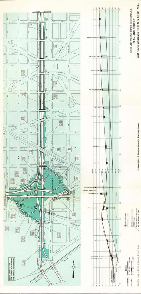
The following maps show the DC freeway system as the design had evolved by the 1970s:


The federal action of retaining the earlier unpopular routings is consistent with the crafted controversy of the scuttling of the B&O route via the 1964 betrayal of the recently assassinated JFK's planning, the FHWA cir 1967-1968 waffling, along with such things as the highly questionable "support" of such organizations as the Federal City Council.


Should not the FHWA de-maping page instead show maps as these found on Scott M. Kozel's informative site Roads to the Future - and that below of what Maryland canceled in July 1973?

PEPCO-B&O I-95

I was once told by an elderly lady involved with the anti-freeway protests of the 1960s and 1970s that despite the design and routing evolution of that time that had lead to the development of plans that were far far less controversial, that the Feds in fact had formally retained the infinity more controversial earlier plans, thus crafting the levels of anti urban freeway sentiment sufficient to bring about the 'de-mapings.'

I had found that too incredible to believe particularly with the design evolutions that had occurred.  However, the FHWA 'de-maping' page shows maps backing that up.

View the page for yourself:

http://www.fhwa.dot.gov/highwayhistory/data/page05.cfm

Withdrawal of I-70S, 95, 66, 266, 295, 395 &695 -- Washington, DC

Description of Withdrawn Routes
The withdrawal of seven Interstate Routes or portions thereof (I-70S, I-95, I-66, I-266, I-295, I-395 & I-695) in Washington, DC was accomplished in six stages.
Withdrawal Action
Stage One

On June 27, 1975, Mayor Walter E. Washington requested the withdrawal of two segments from the Interstate System: (a) I-95 between I-295 and the Maryland State line and (b) all of I-70S in the district.

On October 3, 1975, Federal Highway Administrator Norbert T. Tiemann and Urban Mass Transportation Administrator Robert E. Patricelli approved the withdrawal of the two routes under the provisions of 23 U.S.C. 103(e)(4). The withdrawal removed 5.4 miles in DC from the Interstate System.

In accordance with Section 103(e)(4), DC's unobligated balance of Interstate Construction (IC) funds was increased by approximately $159.2 million to $304.3 million since the withdrawal was approved prior to the May 5, 1976, enactment of the Federal-Aid Highway Act of 1976. The increase was accomplished by increasing DC's IC apportionment for FY 1977.

Stage Two

On December 29, 1976, Mayor Walter E. Washington requested the withdrawal of two more segments from the Interstate System: (a) the portion of I-66 between I-266 and I-395, and (b) the I-266 Three Sisters Bridge over the Potomac River to the Virginia State line. The two route portions total 2.50 miles.

On April 29, 1977, Federal Highway Administrator William M. Cox and Urban Mass Transportation Acting Administrator Charles F. Bingman approved the withdrawal of the two routes under the provisions of 23 U.S.C. 103(e)(4).

In accordance with Section 103(e)(4), DC's unobligated balance of IC funds was decreased by approximately $103.5 million accomplished by decreasing DC's IC apportionment for FY 1977.

Stage Three

On August 7, 1978, Mayor Walter E. Washington requested the withdrawal of portions of the East leg and North Leg Freeways (I-295 and I-395).

On September 8, 1978, Federal Highway Administrator Karl S. Bowers and Urban Mass Transportation Administrator Richard S. Page approved the withdrawal under the provisions of 23 U.S.C. 103(e)(4). The two route portions total 4.70 miles.

In accordance with Section 103(e)(4), DC's unobligated balance of IC funds was decreased by approximately $130.1 million accomplished by decreasing DC's IC apportionment for FY 1977.

Stage Four

On April 30, 1980, Mayor Marion S. Barry requested the withdrawal of a 1.7-mile segment of the South Leg Freeway portion of I-695 between I-66 and I-395.

On August 27, 1980, Federal Highway Administrator John S. Hassell and Urban Mass Transportation Deputy Administrator Lillian C. Liburdi approved the withdrawal under the provisions of 23 U.S.C. 103(e)(4). In addition a 0.12 mile segment of I-695 was deleted from the Interstate System under Section 103(f).

In accordance with Section 103(e)(4), DC's unobligated balance of IC funds was decreased by approximately $45.9 million accomplished by decreasing DC's IC apportionment for FY 1980.

Stage Five

On January 27, 1982, Mayor Marion S. Barry requested the withdrawal of the westerly 0.6-mile segment of I-266 between the Three Sisters terminus and Key Bridge.

On June 28, 1982, Federal Highway Administrator R. A. Barnhart and Urban Mass Transportation Administrator Arthur E. Teele approved the withdrawal under the provisions of 23 U.S.C. 103(e)(4).
In accordance with Section 103(e)(4), DC's unobligated balance of IC funds was decreased by approximately $10.8 million accomplished by decreasing DC's IC apportionment for FY 1982 and 1983.

Stage Six

On May 19, 1983, Mayor Marion S. Barry requested the withdrawal of (a) the remaining 0.51-mile segment of I-266 and (b) a 0.25-mile segment of I-66 within the I-66/I-266 interchange area.

On August 19, 1983, Federal Highway Administrator R. A. Barnhart and Urban Mass Transportation Acting Administrator G. Kent Woodman approved the withdrawals under the provisions of 23 U.S.C. 103(e)(4).

In accordance with Section 103(e)(4), DC's unobligated balance of IC funds was decreased by approximately $12.9 million accomplished by decreasing DC's IC apportionment for FY 1983.
Withdrawal Value
The "Base" withdrawal value was based on the Federal share of the cost to complete these Interstate routes as reported in the Interstate Cost Estimate (ICE) at the time of the withdrawal. The Base cost was adjusted quarterly to determine a new withdrawal value in accordance with Section 125 of the Federal-Aid Highway Amendments of 1974 reflecting variations in the cost of construction. The adjustment due to construction cost variances was terminated by the Surface Transportation Assistance Act of 1982. These values are shown in the following table:

Withdrawal Value & Obligations -- Washington, DC
Stage One Base Cost (1975 ICE)304.3 million
Stage Two Base Cost (1975 ICE)300.6 million
Stage Three Base Cost (1977 ICE)403.5 million
Stage Four Base Cost (1979 ICE)230.4 million
Stage Five Base Cost (1981 ICE)110.2 million
Stage Six Base Cost (1981 ICE)121.8 million
Obligations for Highway Projects233.4 million
Obligations for Transit Projects1,963.5 million
Remaining Entitlement0.8 million
Final Withdrawal Value2,197.7 million


Map of Washington, DC Stage 1 Interstate Highway withdrawals
Map of Washington, DC Stage 2 Interstate Highway withdrawals
Map of Washington, DC Stage 3 Interstate Highway withdrawals
Map of Washington, DC Stage 4 Interstate Highway withdrawals
Map of Washington, DC Stage 5 Interstate Highway withdrawals
Map of Washington, DC Stage 6 Interstate Highway withdrawals
Map of Washington, DC Stage 7 Interstate Highway withdrawals


See some detailed histories here:

http://wwwtripwithinthebeltway.blogspot.com/2012/01/crafted-controversy-scuttling-of-jfks-b.html
http://wwwtripwithinthebeltway.blogspot.com/2014/09/getting-over.html
And see this as an example of how media entities over simplify the history- willfully.
http://wwwtripwithinthebeltway.blogspot.com/2015/01/the-washington-city-papers.html

Saturday, March 10, 2007

I-66 North Leg West K Street Tunnel

I-66 North Leg West K Street Tunnel,
DeLeuw, Cather, with Harry Weese "District of Columbia Interstate System" November 1971

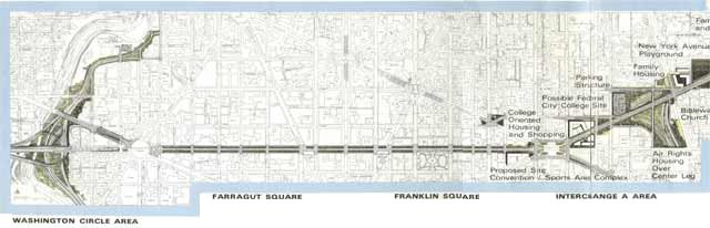
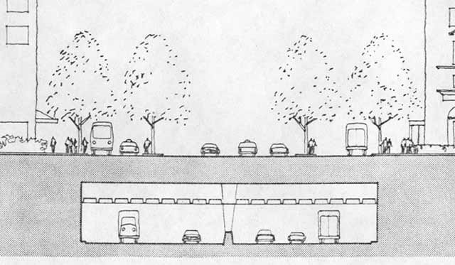
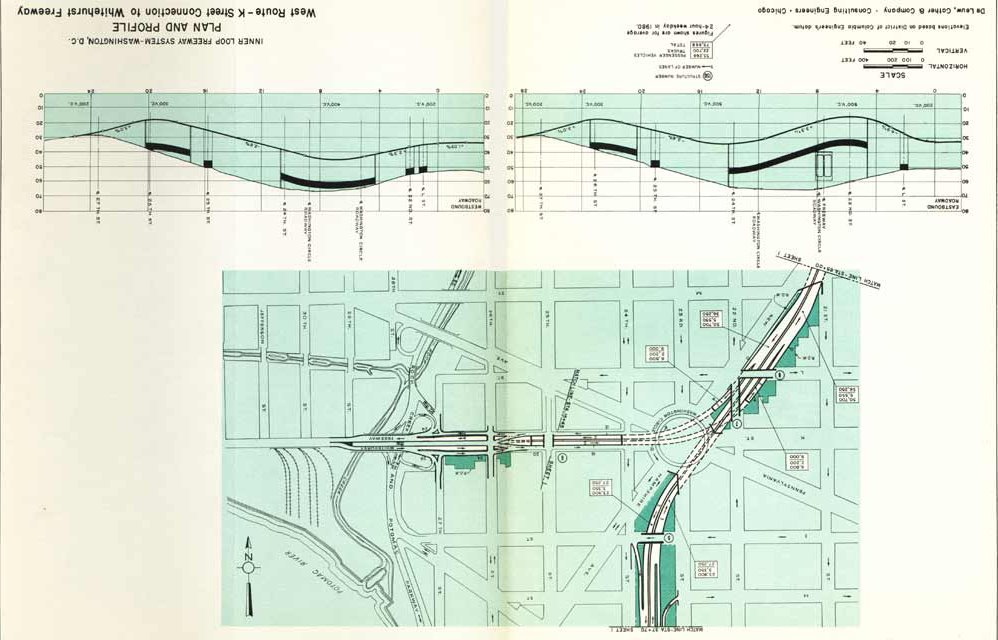
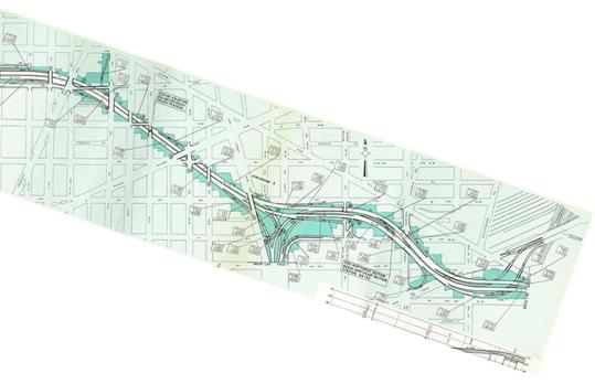
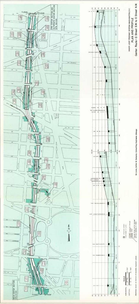
The K Street Tunnel was to be built beneath the existing 147 foot wide right of way K-Street with 6 lanes plus shoulders from Washington Circle eastward to connect with the Center Leg.

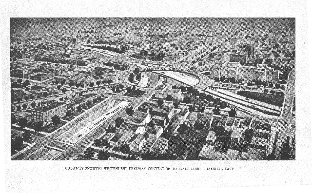
Overview: The I-66 K Street Tunnel was the end product of a search for a tunneled I-66 North Leg option with the best benefit to cost ratio, to provide this express east-west urban highway without massive building demolition or a localized separation of an open trench or elevated bermway that made the previous I-66 North leg proposal along Florida Avenue and U Street extremely unpopular. To see this earlier plan, see plates 1 and 3 at 1955-62 Plans.
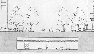


Building this freeway as a cut and cover tunnel beneath the right of way that happened to be both D.C.'s widest east-west right of way, as well as being on a straight line with the Georgetown waterfront and New York Avenue, would be more cost effective then separate one way tunnels beneath any of the parallel and narrower streets, while eliminating the need for building removal for almost its entire length. Although more expensive per lane mile to construct then the preceding Florida Avenue U Street option, the K Street tunnel route was shorter and did not reduce taxable real estate square footage.

It was initially promoted by Elizabeth Rowe, then Chairman of the National Capital Planning Commission in 1965, who 8 years later would promote its cancellation "for all time" with the other un built D.C. highways to increase WMATA funding from 2/3rds to 80% in the wake of arguments that the world was running out of petroleum, hence, making private automobiles obsolete by the 1990s.


History: The K Street Tunnel first appears during the mid-1960s in the wake of the October,1963 establishment of a Policy Advisory Committee on the North Leg, which concluded that highway be constructed in tunnel to the maximum extent feasible, either as a 4 or 6 lane tunnel. 


Other tunnel options considered involved drilled (moled) technologies under parallel streets to the north, and were studied with access ramps that would have required some adjacent properties and building demolition. The route considered included parallel one way tunnels beneath Q and R Streets, in order to avoid potential conflict with the traffic circles to the south.

The first engineering study for the I-66 K Street Tunnel itself occurred in 1965 or 1966; it was conducted by Edwards and Kelcey, and included detailed functional plans at a scale of 1" = 200', but which never reached the report stage; as then considered it would run beneath K Street all the way to the Center Leg Tunnel (3rd Street Tunnel). The concept received favor in such Washington, D.C. newspaper editorials as the following of December 24,1965:
The new proposal to build a six-lane freeway in a tunnel under K Street Northwest, from the Potomac River to a connection with the Center Leg freeway near Third Street Northwest has several advantages which are immediately apparent.

It would preserve intact the essential concept of a continuous inner loop freeway system around the downtown shopping area. Indeed, its connection wit the maze of freeways in the Georgetown-Foggy Bottom area would provide a shorter, more direct route to the east than the alternative road location, swinging northward to Florida Avenue, which city highway planners have previously supported.

It would avoid completely the displacement of hundreds of families and of dozens of business establishments, which would be required along the original route. The width of K Street is147 feet. Since the right of way is publicly owned little or no private property would be taken. Since it runs largely though a commercial area, disruption to residential neighborhoods would be adverted. In terms of cash, the cost in all likelihood would be no greater than the controversial Florida Avenue route.

Most interesting of all, from the viewpoint of the politics involved in the inner-loop controversy, the new route was advocated by Elizabeth Rowe, the National Capital Planning Commission chairman, who previously had blocked any east-west freeway north of the shopping districts. By her adamant position, Mrs. Rowe had also halted progress on every other crucial element of the freeway system in the western part of the city, including Maryland’s George Washington Memorial Parkway and a new Potomac Rive bridge in the Rosslyn area.

At a series of secret, informal meetings during the last several months however, the half-dozen federal and District officials with the authority to make decisions on all aspects of he freeway network have been trying to reach agreement on a single package of proposals which would permit the entire program to proceed. That is the context in which Mrs. Rowe’s K Street Tunnel proposal was advanced- and it is the context in which highway officials have agreed to consider it.

To be sure, there are a number of questions as to the feasibility and cost of the K Street project which still require answers. The inconvenience and disruption along K Street, during construction would be enormous. The work would have to be carefully staged, so as to hold the impact to a minimum. The highway department contends the new proposal would be less efficient then the original route in terms of the city’s total traffic-distribution plan. It is keeping its fingers crossed on this point until consultant studies now under way are finished next February.

The new proposal, however, fully deserves the intensive study it is receiving- provided Mrs. Rowe and everyone else understands that it is only one part of a package of agreements which will break the whole freeway stalemate. That condition should be made perfectly clear. Piecemeal decisions on a single project are not good enough. The time has come now for agreement on this entire program.
The concept received favor in a Sunday, July 31, 1966 article in The Washington Post by Wolf Von Eckard, Freeways Enter the City.
Unfortunately, neighborhoods are easily disrupted and destroyed by plowing through them, particularly if they are occupied by groups with no great ability to bring pressure on City Hall.
It will be well to remember this for instance, when our highway planners approach Takoma Park, the ten-lane North Central Freeway would split this proud old tightly-knit and unusually diverse community right in half.

Frequently then freeways must be tunneled, an approach the high builders usually oppose not only because it is expensive, but also because driving through a tunnel is an unpleasant experience. Not necessarily so says Halprin. Properly designed, they could have all the qualities of a handsome environment. The walls might be lined with bas-reliefs and other works of art to be seen in motion, as the vaults of the Stockholm subway. Widths of tunnels can vary; light may be brought in from the top; and there might be vast underground plazas with shops and arcades, theaters and restaurants and, of course, parking places.

The proposed K Street tunnel, which will replace the [open depressed] North Leg of the Inner Loop, offers an excellent opportunity to do just that. It could become a model for others to follow- an example to the world on how America, which produced automobiles, learned to cop with them.
The I-66 North Leg K Street Tunnel concept was generally favored by groups involved with modifying Washington, D.C.’s road plans. Through the efforts of Elizabeth Rowe and others, the U.S. National Capital Planning Commission favored the K Street Tunnel to replace the preceding Florida Avenue- U Street. This was similarly true with the D.C. City Council.

Involving the most direct and widest existing right of way, the K Street Freeway Tunnel concept had much arguing in its favor as the shortest and cheapest route for a tunnel, but the existing geometric problems of its western and eastern connections. This was a stated reason for the D.C. Department of Public Works opposition to the K Street Tunnel, along with its lack of downtown access ramps.
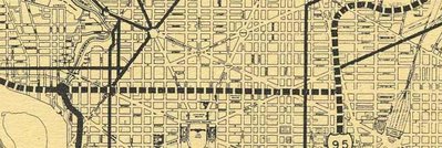

Early I-66 North Leg West K Street Tunnel proposal
From the 1966 North Central Freeway Supplementary Study

(I have not seen information regarding how the tunnel beneath the K Street axis at Mt Vernon Square was to be achieved,
 either via removing the Carnegie Library, or by somehow going directly beneath that structure.)


Early Design Interchange Problems: The earlier designs carrying this tunnel strictly beneath K-Street from the Whitehurst Freeway to 3rd Street NW, presented geometric problems at both of its ends. At its west in Foggy Bottom, the I-66 West Leg/North Leg connections involved tight, even descending radii with some building demolition. At its east it would have required a large interchange at K Street and 2nd Streets that would likely trisect the area.

Planers got around these problems by more employing the L’Enfant Plan, particularly the easier angles provided by K Street’s respective intersections to the west with Pennsylvania Avenue and to the east of the New York Avenue. These basic ideas were in place by the 1971 study.

The idea for the connections from the K Street Tunnel to the I-95 Center Leg, east of Mt Vernon Square along New York Avenue, appears in a 1967 proposal from the Urban League neighborhood Advisory Council, which issued a proposal NEW YORK AVENUE TUNNEL-- A CITIZENS" ALTERNATIVE TO FREEWAYS
Residents in the near northwest, northeast, and Center Leg areas have developed a proposal to turn the Center Leg traffic into New York Avenue. This proposal has many advantages:

1. A K Street-New York Avenue tunnel route would handle east-west traffic.

2. This route could become the North Leg of the Inner Loop system, connecting with the East Leg.

3. The Center Leg would be halted at New York Avenue, thus
    -- Saving countless homes
    -- Keeping the Inner Loop out of the Shaw area
    -- Keeping the Freeway away from the new housing and community developments in Northwest I
    -- Preserving the site for air rights housing-- Protecting the unity of the northwest community
    -- Allowing proposed plans for the expansion of Dunbar High School to be adopted without threat of disruption.

      An eastern tunnel approach beneath and or along New York Avenue would provide a gentler east to north-east transition at Mt Vernon's eastern side at 9th Street NW, thus providing an ultimately more workable solution for connecting with, and for routing the Center Leg's extension via re-enforcing the utility of New York Avenue


      In order to tunnel beneath Mt. Vernon Square without disturbing the foundations of the historic Carnegie Library, it appears that the 1971 design routed both directions of the I-66 tunnel to this library’s north, including a portion now occupied by the Convention Center.


      Downtown Ramp Access: Working more with the L’Enfant plan with the superior geometry of its K Street transitions with Pennsylvania and New York Avenues, placing the western and eastern approaches allowed access ramps at both of these ends. Under the 1971 plan, the Pennsylvania Avenue segment had ramps to I-66 to and from the east for improving Maryland access to Georgetown, and to Massachusetts Avenue to I-66 to and from the west just to the southeast of Mt. Vernon Square for improving Virginia traffic to Chinatown. It may have had an additional ramp from I-66 just east of Washington Circle, which would have been feasible of planning had taken the opportunity provided by real estate building demolition and replacement that occurred anyway. It does not appear that any other locations for such ramps were even considered.

      Working with a Washington, D.C. highway system to feature an Whitehurst Freeway upgraded to 8 lanes to a 4 lane George Washington Memorial with an all new bridge crossing 1/8 mile west of the Key Bridge at 3 Sisters Island.


      Connection Considerations with other system segments:


      The I-66 K Street Tunnel, was the main part of a link with I-66 to I-95 and Route 50, and was designed as part of a system that was to include an improved westerly continuation, designated as I-266, via a Whitehurst Freeway corridor upgraded to 8 lanes leading to a 4 lane Canal Road Parkway, with I-266 continuing into Virginia via a new Three Sisters Bridge. Under the 1971 plan, the 6 lane – 3 per direction – K Street Tunnel would split to a 4 lane – 2 lane per direction – connection with I-266, with only a 2 lane – 1 lane per direction with the I-66 West Leg.

      As a replacement for the original I-66 North Leg via an open depressed route along Florida Avenue and U Street, the I-66 K Street Tunnel plan was criticized for its relative lack of down town access. Hence in addition to the above mentioned ramps, the 1971 plan included a "penetrater” road at its western end that would continue north to underpass Pennsylvania Avenue to met a traffic light intersection with M Street, and then to meet the surface street network at N Street and 24th Streets NW.

      Because of the need to avoid the Carnegie Library at Mt Vernon Square, the 1971 design had the tunnel swing to the north, overlapping with the Convention Center and to the east along the north side of New York Avenue. This connection to the east along the north side of New York Avenue, was where the 1971 design for the cross-town D.C. I-66 Tunnel had a residential displacement of 145. This was in sharp contrast to the destruction of 2393 family housing units with 8376 persons of the Florida Avenue/ U-Street plan.

      The project was designed in concert with the WMATA train subway system.


      As described in the 1971 DeLuew, Cather and Wesse report:
      From McPherson Square to Mount Vernon Square, an enclosed tunnel is envisioned.  The surface street would be restored to its present cross section.  Between Washington Circle and Mount Vernon Square, the tunnel would be built within the existing right of way.  Additional right of way takings into Pennsylvania Avenue and Massachusetts Avenue would be minimal.  Landmarks such as the Carton Hotel, Franklin School and Southern Methodist Church would remain intact.  Special studies indicate that the Mount Vernon Library could be maintained during tunnel construction, but only at a cost of several million dollars.

      The present surface configuration of K Street consists of a four lane main roadway flanked by two lane service drives with a row of trees in each separator.  K Street's layout is unique in the District and should be retained or restored.

      The 148 foot width of the thoroughfare from property line to property line is found on only a few other major streets in the district.  It was considered appropriate, therefore, to extend the three roadway treatment eastward from 2th Street to 9th Street at the western edge of Mount Vernon Square.  This area, as has been noted previously, is a high priority area under present public programs and warrants such a design.

      Parks which now project into the right of way of K Street would be retained


      Nonetheless, the I-66 North Leg K Street Tunnel became one of the first D.C. highway links canceled following the July 1973 cancellation of the I-95 Northeast Freeway.  This would be via a political deal to cancel it along with the far better known and highly controversial I-266 Three Sisters Bridge Project. In an article appearing in The Washington Post on May 13, 1977, Douglas B. Feaver, Washington Post Staff Writer wrote (at Page B1):
      The Three Sisters Bridge, a once locally famous proposed interstate highway project that was to span the Potomac River above Georgetown, officially was killed for the third or fourth time yesterday. This time it looks unusually permanent.

      Announcement of the death of a project that had long-since been regarded as abandoned by highway officials came from Mayor Walter E. Washington. The city of Washington, he said, has received approval from the U.S. Department of Transportation to transfer U.S. Money from the bridge and another less-famous highway project to the Metro construction fund. The less-famous project was the K Street tunnel, which was going to carry lanes of automobiles across town. The total amount of federal money made available by killing the two projects is $392 million. About $344 million will go to Metro, the rest to other D.C. street and bridge improvements the mayor said.

      The Three Sisters Bridge - so named because it would cross the Potomac at the point where three rocks known as the Three Sisters are located - was to connect a branch of Interstate 66 with an un built District of Columbia freeway. The branch of I-66 also is now dead, as is the D.C. Freeway.

      Construction on the Three Sisters actually began in 1970, and about $1.2 million in work was completed before a court order stopped it. Before that court order, there were several days of media events - people standing in front of bulldozers, chanting, and making speeches about the ecological disaster of highway projects.

      Another popular rallying cry in the anti highway movement was that the Three Sisters and other now defunct D.C. roads would be "white men's roads through black men's bedrooms."
      According to the 1971 DeLeuw-Cather-Weese study, the I-66 K Street Tunnel North Leg would serve an estimated 88,000 vehicles per average weekday.

      Of this traffic, 32% would have an origin or destination within Downtown Washington, plus 14% cross-town traffic both originating and destined within this urban area, and 24% estimated to have either an origin or destination within D.C. further from the Central Business District, with 30% making trips between Virginia and Maryland.

      The K-Street Tunnel was seen as a central component in any conceivable D.C. Highway program, being included in every variant of a D.C. highway network considered during the later 1960s and early 1970s, and included in COG documents as late as 1977, rated as presenting the highest degree of traffic relief for any individual highway project, with significant extra capacity for at least the next 20 years.

      Of all the highway projects of the 1960s and 1970s that were canceled, the K Street Tunnel was by almost any indication the least controversial, having the greatest compatibility with the L' Enfant plan-derived street grid and hence its greater use and reconciliation of the existing environmental footprint. It enjoyed the early support of the D.C. City Council and the National Capital Planning Commission, but would not be the choice of the D.C. Department of Public Works until 1969-70, and the adaptation of the later designs for its interchanges at its western and eastern ends.

      However, the proposed I-66 K Street succumbed to a scheme to increase the Federal share of WMATA rail funding from 67% to 80%.. According to a 1976 Memo by Peter S. Craig, canceling the I-66 K Street Tunnel would yield $399.4 million in Federal funds and $44.3 million in local D.C. funds for a total of $443.7 million in funding WMATA.

      There would be no apparent consideration of the increased costs of not building these highways, nor of the failure to plan for them for a future date, as these highway cancellations would be then described as being "for all time."[!] Nor was there any apparent consideration of the I-66 K Street Tunnel's high degree of employing and serving the existing developed footprint, plus new real estate development east of North Capital Street along the brown fields along New York Avenue.

      "De-mapping" "for all time" -- the words of then DC Mayor Washington -- the I-66 K Street Tunnel would thus remove any requirements that adjacent projects accommodated it, such as preserving its easement.

      A 1976 Council of Government report simply concluded that:
      "The North Leg Freeway, or K-Street Tunnel, does not appear warranted on the basis of predicted traffic."

      "As can be seen in assignments for Alternatives 1, 2, and 3, the volume predicted for K-Street will slightly exceed service volume at level D. This prediction is without constraints. It is believed that with traffic management strategies, coupled with some change in planned development, K-Street can operate adequately. In view of the enormous cost of the proposed tunnel, the marginal improvement it would provide would appear unjustified. (Without the road tunnel, the Farragut North and Farragut West METRO stations can be linked by a pedestrian tunnel)." traffic management strategies [unspecified] coupled with some change in planned development.
      No mention was given to its many previously acknowledged benefits, such as its favorable cost benefit ratio over the original 1955 plan for not requiring massive displacement and for being a shorter route.

      No mention is given to the utility of the east-west utility of such a cross town tunnel connecting I-66 with Route 50 in time-savings and in directing new real estate development along Washington, D.C.’s New York Avenue corridor, nor even the logic of continuing the I-66 designation east of the Center Leg.

      Nor is mention given to its highly efficient use and encouragement of re-use of the existing developed footprint.


      Friday, December 01, 2006

      1955-62 Plans

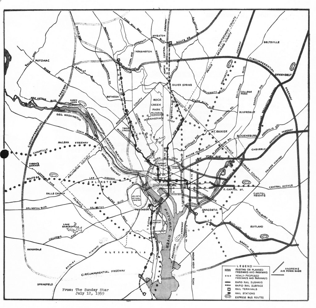
      1959 Mass Transportation Plan

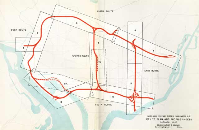
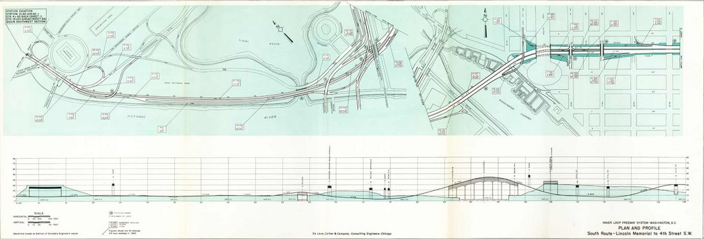
      1955 Inner Loop Freeway Proposal


      1955 Inner Loop Freeway Proposal Guide to Plates


      Plate 1


      Plate 2


      Plate 3


      Plate 4

      Plate 6


      Plate 5


      Plate 7

      Plate 7A


      Plates 9a and 8
      W

      1955 Inner Loop Whitehurst - West Leg Interchange


      1955 Inner Loop North Leg - East Leg Interchange

      North Leg West


      North Leg East


      SW Freeway


      1957 design West Leg interchange


      1957 Route 240 Northwest Freeway
      along Georgetown waterfront


      1957 Route 240 Northwest Freeway
      at Chain Bridge


      I-66 North Leg West with dotted lines indicating I-70S at 14th Street and the North Central Freeway at Sherman Avenue (note the tight spacing between these interchanges!)


      1959

      part tunneled east-west Cleveland Park I-70S segment-
      west of Rock Creek Park


      open depressed Mt. Pleasant I-70S segment-
      east of Rock Creek Park


      1960

      This 1960 I-95 route could feed directly into the I-295 East Leg along 11th Street NE/SE.


      1961

      A 1961 rendering of the SW/SE Freeway, with unadopted route for SE Freeway along southern side of railroad.

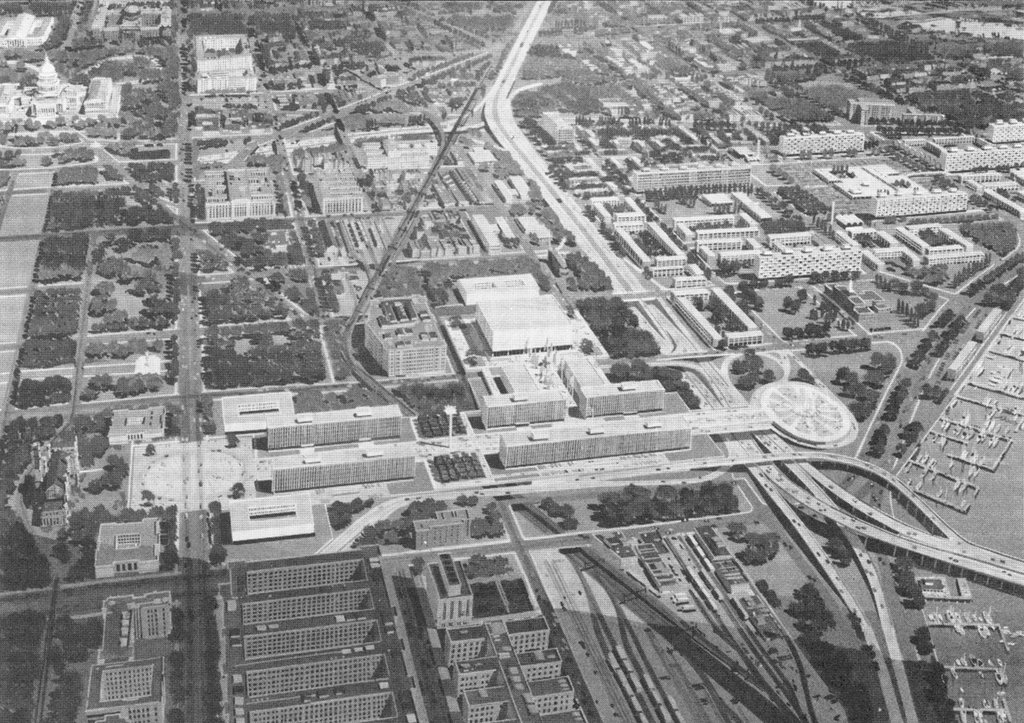
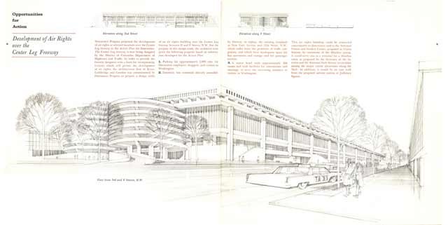
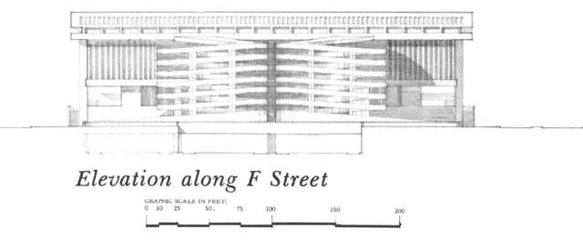
      A 1961 rendering of a proposed parking garage atop the Center Leg at F Street NW