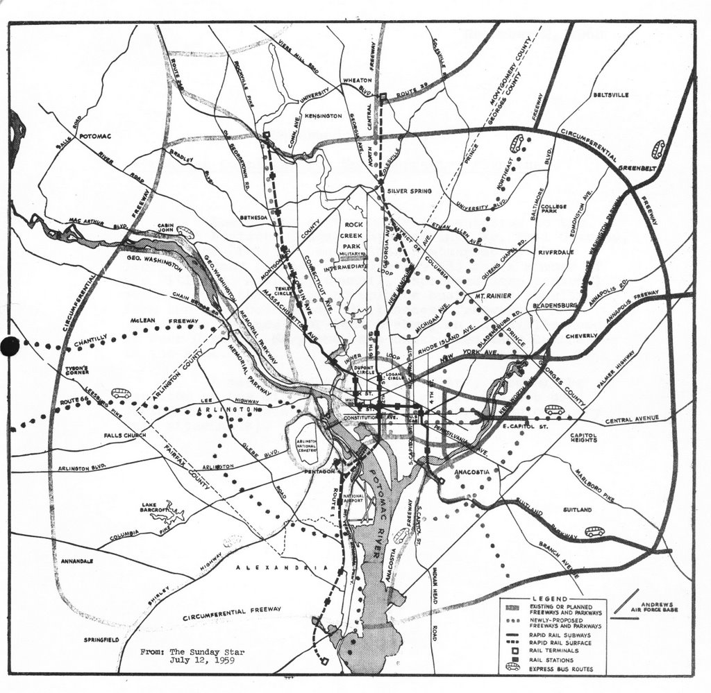
 1959 Mass Transportation Plan
 1955 Inner Loop Freeway Proposal
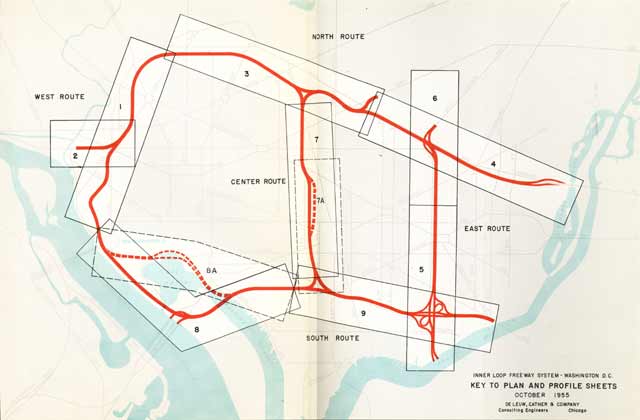
1955 Inner Loop Freeway Proposal Guide to Plates

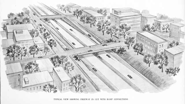
Plate 1
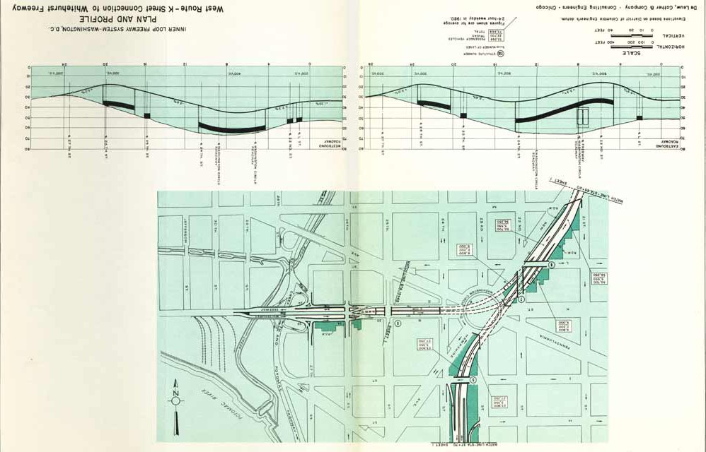
Plate 2
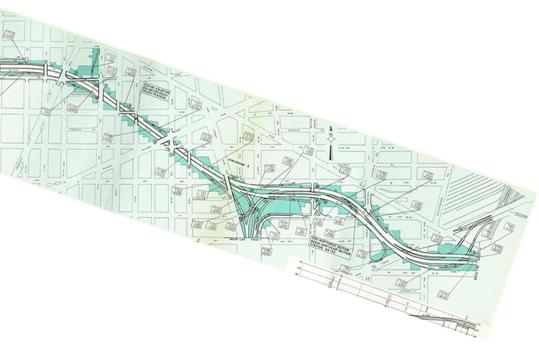
Plate 3

Plate 4

Plate 4

Plate 6
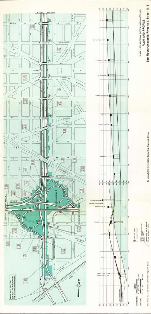
Plate 5
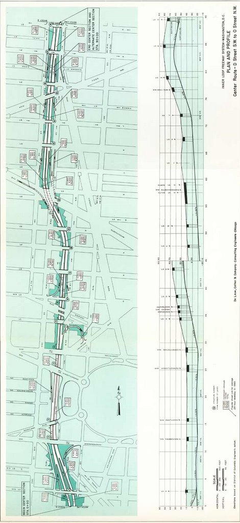 Plate 7
 Plate 7A
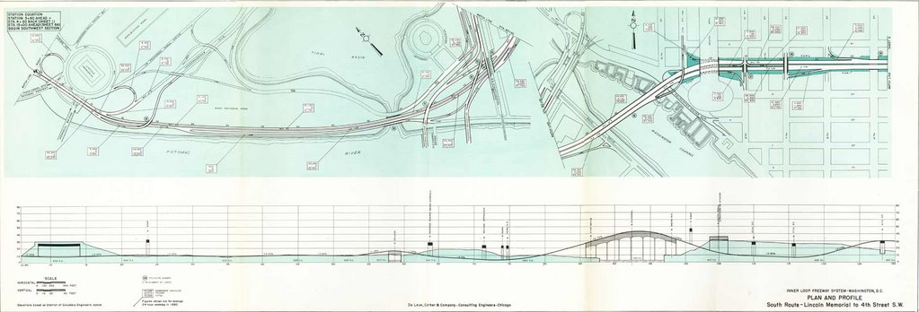
 Plates 9a and 8
W
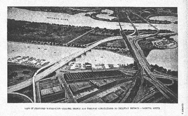
 1955 Inner Loop Whitehurst - West Leg Interchange
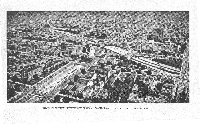
 1955 Inner Loop North Leg - East Leg Interchange
 North Leg West
 North Leg East
 SW Freeway


1957 design West Leg interchange
 1957 Route 240 Northwest Freeway
along Georgetown waterfront
 1957 Route 240 Northwest Freeway
at Chain Bridge
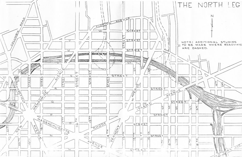
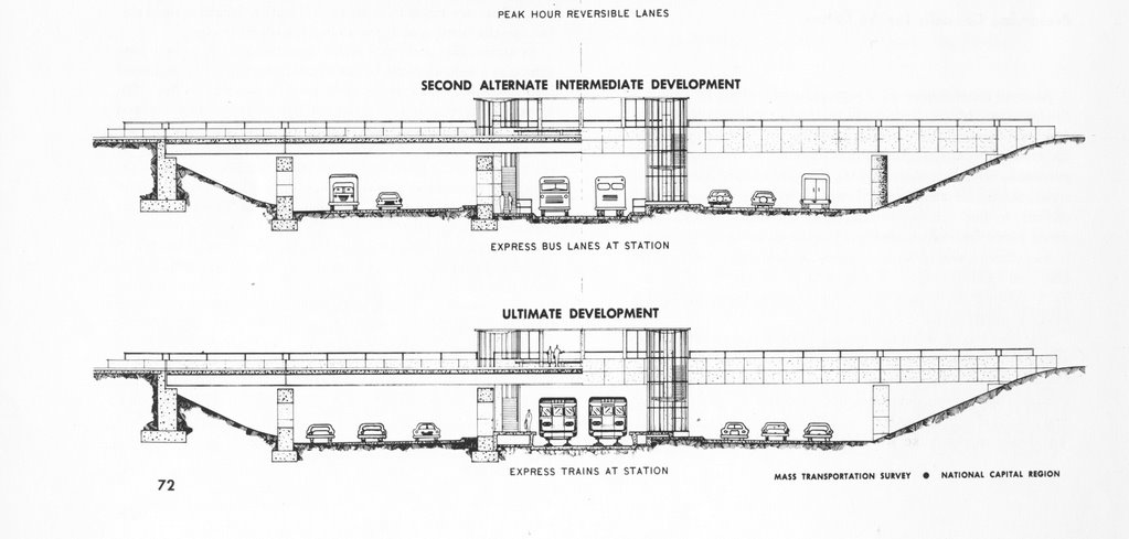
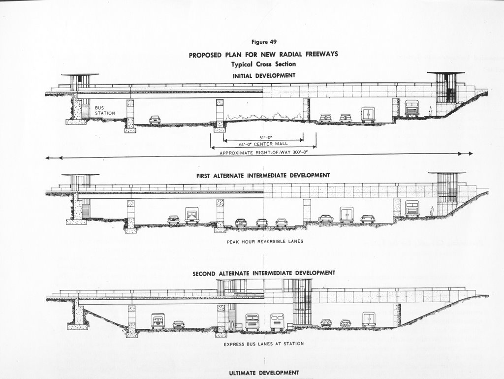
I-66 North Leg West with dotted lines indicating I-70S at 14th Street and the North Central Freeway at Sherman Avenue (note the tight spacing between these interchanges!)

1959

part tunneled east-west Cleveland Park I-70S segment-
west of Rock Creek Park
west of Rock Creek Park

open depressed Mt. Pleasant I-70S segment-
east of Rock Creek Park
east of Rock Creek Park
1960
 This 1960 I-95 route could feed directly into the I-295 East Leg along 11th Street NE/SE.
1961
 A 1961 rendering of the SW/SE Freeway, with unadopted route for SE Freeway along southern side of railroad.
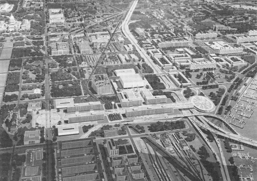
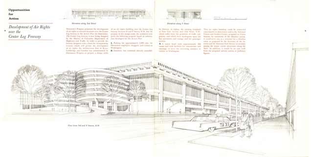 A 1961 rendering of a proposed parking garage atop the Center Leg at F Street NW
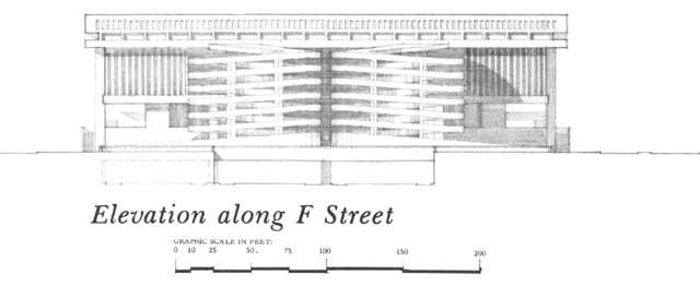


3 comments:
Awful stuff. Thank God that only some of this was built, hopefully someone will have the willpower to demolish the freeways inside the city and restore life to the cut off areas.
BTW do you have larger versions of these images? I'd love to get them if you dont mind.
thanks
Which images in particular?
If its the 1955 Inner Loop or the I-695 South Leg, the problem is that the initial hi resolution scans are on a hard drive that I have been unable to read, and that I apparantly had failed to copy the hi res versions to another drive, transferring only the lower resolution ones that I created later.
I did the scanning at the GW Gelman Library Special Collections division, of the Committee of 100 and Peter Craig papers, which had copies of the 1955 Inner Loop engineering report, and I have seen the same documents at the DC MLK Library Washingtonia Division (see my currently latest post for the links).
Ironically, the portion of the Inner Loop that was built has the worst design regarding local effects, e.g. open pits not designed to be covered, and elevated bermways of vacant walls as a streetscape. The only other such elevated bermway unbuilt portion was the Northeast Leg from the Center Leg to Gallidet University. The original North Leg was atr least depressed with some talk of covering at least its far western portion to a bit east of Connecticut Avenue; however the building loss would have been severe in quantity and quality.
Why that so many scholars of urban design seem blind to the differences in highway design, particularly regarding the later I-66 North Leg K Street Tunnel which took almost no buildings contradicts the first principle of urbanity to provide different levels of human activity, contrary to that of say a suburban ranch house.
A monument of this to me is the existing configuration of the above ground D.C. Metropolitan Branch WMATA Red Line railroad northwards from Union Station.
BTW- Interesting blog of yours.
I found the unprocessed scans, stitched them together and uploaded them.
New page:
1955 Washington, D.C. Inner Loop Engineering Study
http://wwwtripwithinthebeltway.blogspot.com/2007/01/blog-post.html
Image upgrades can be found in the various other pages with 1955 Inner
Loop illustrations, including:
http://wwwtripwithinthebeltway.blogspot.com/2006/12/1950-62-plans.html
http://wwwtripwithinthebeltway.blogspot.com/2007/03/i-95-center-leg-t...
http://wwwtripwithinthebeltway.blogspot.com/2007/03/i-295-east-leg-to...
Also, additions at '101'
http://wwwtripwithinthebeltway.blogspot.com/2009/01/trip-within-beltw...
Post a Comment