 I-70S at Friendship Heights, at the Maryland-District line
This was originally the left hand northern radial, west of the North and Northeast Freeways, appearing in the 1959 Mass Transportation Plan. It was to serve as the south or inside the Beltway extension of I-70S (today’s I-270) from its eastern spur’s connection with the Beltway at Pooks Hill, paralleling Wisconsin Avenue through downtown Bethesda, Maryland to Friendship Heights at the Maryland-District of Columbia line.
It would run about 500 west parallel to Wisconsin Avenue before crossing to its east at Fessington Street before turning south (today’s WMATA parking lot outlines a portion of this route) into a tunneled underpass beneath Tenley Circle.

Northern Wisconsin Avenue Corridor

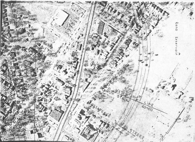

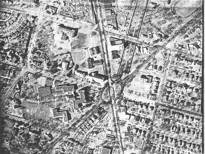
The Tenley Circle Tunnel was proposed earlier as a segment of the Fort Drive Parkway (Intermediate Loop, that would have continued south through Archibald-Glover Park to the Georgetown waterfront to continue with an expanded Whitehurst Freeway facility). 
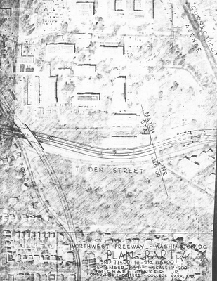
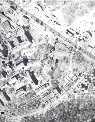
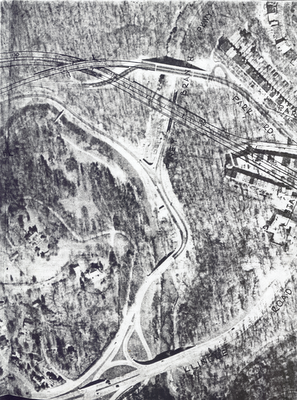
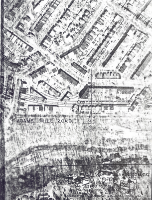
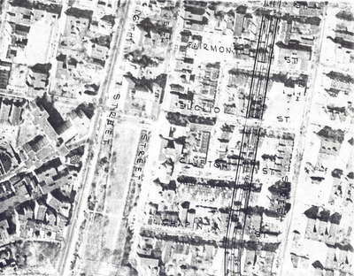
Because of opposition to a road through Archibald Glover Park open to trucks, this 1959 plan had I-70S continue via a separate spur known as the Cross Park Freeway. That would have turned due east, entering a set of 1,100’ long bored tunnels to avoid Fannie Mae and Sidwell Friends properties, to a depressed segment along Tilden Street at the north edge of the Cleveland Park neighborhood leading to another tunnel ,this one cut and cover to cross east of Connecticut Avenue.
These tunnels were a 1959 addition suggested by NCPC that July, to the previous proposal which had those segments as open deep trenches. This change would raise the estimated construction costs by $10 million (while replacing 6 planned lanes with only 4), and was advanced by NCPC Chairman William E. Finley as noise abatement for the nearby properties.







Wisconsin Avenue Corridor Segment

Bored Tunnel

Connecticut Avenue Tunnel

Rock Creek Park East and through the Mt. Pleasant neighborhood
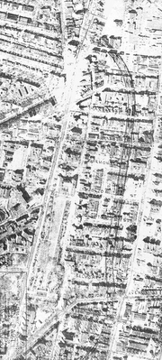
There, it would have continued as an open depressed freeway with no tunneled segments, turning south to parallel 14th Street NW to meet the I-66 North Leg of the Inner Loop just south of U Street NW.

1959 I-70S interchange with I-66 North Leg
The segment in DC to just south of Tenley Circle would have taken 64 dwellings. The segment of the Cross Park Freeway west of Rock Creek Park along the north edge of Cleveland Park would have taken perhaps 20.

east-west Cleveland Park segment- west of Rock Creek Park
dashed segments tunneled
The segment east of Rock Creek Park through Mt. Pleasant would have taken 100s. Perhaps over 1,000.

Mt. Pleasant segment- east of Rock Creek Park
non tunneled
No engineering studies were conducted by Maryland for the Bethesda segment, however at least half or more of downtown Bethesda got torn down and replaced with denser development as induced by the construction of the WMATA red line. Nor was any serious consideration ever given to coordinating this, nor with creating it as cut and cover nor drilled tunnel. Hence, Bethesda never even attempted to formally justify their unjustifiable decision to maintain a traffic disaster directly upon Wisconsin Avenue that was further exacerbated by the WMATA induced denser development: the public interest and the need for improved evacuation routes be damned!. However, some more progressive factions apparently did try reviving this much needed freeway during the mid 1960s as illustrated below.

Bethesda proposal 1965

I-66 and I-70S Downtown Washington, D.C.
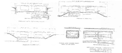

1959 I-70S Northwest Freeway Cross sections
along the northern edge of Cleveland Park
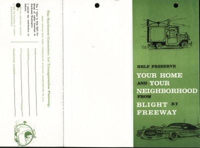
Although some 2/3rds of the Cleveland Park area route was tunnel, persons there got away with calling it a blight, even as the true injustice was primarily to the east of Rock Creek Park in the Mt. Pleasant area where the freeway was non tunneled


No comments:
Post a Comment