Showing posts with label East Leg. Show all posts

Sunday, January 04, 2015

About the Least Expensive Type of Underground Freeway


See more:
http://cos-mobile.blogspot.com/2015/01/old-and-new-elevated-and-box-tunnel.html

 Eastern portion of 1996 'Ron Linton' New York Avenue Tunnel-
Why does this not swing to the north side of the Avenue east of the Red Line to excavate a parking strip rather than the more difficult option of continuing further east directly beneath the Avenue?

Saturday, November 23, 2013

Wasting the Eastern SE/East Leg Freeway


Eastern end of Washington, D.C.'s SE Freeway beneath Pennsylvania Avenue-Barney Circle
note Congressional Cemetery at upper left, and the Anacostia River at upper right.
Extension to East Capitol Street canceled during the mid or latter 1970s, vis a design first officially adopted about 1963, replacing the earlier proposals for a depressed freeway on a new swath alongside 11sth Street SE/NE.


A proper design could build this with an enclosure atop in the fashion of the existing Barney Circle Overpass - Above Ground Tunnel, with the added fashion of extending Washington, D.C.s Monumental Core eastward- rather than having such merely to the west.  This would be easy to do, with the freeway extension to East Capitol Street, owing to it being somewhat cut into an existing hillside, both to the west and to the east of Barney Circle.

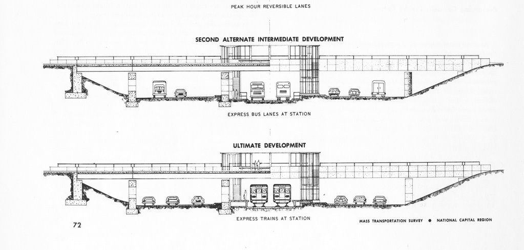
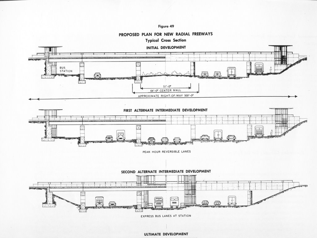
A recent report included illustrations of various cross sections essentially making the segment to the west as an above-ground tunnel, yielding maximum benefit for the broadest segment of society.  Strangely that idea is only conveyed by the illustration, with ZERO recognition in the text, which merely focused upon the restored street grid atop.


The existing plan to destroy the approaches to and beneath Barney Circle should be immediately abandoned, and replaced with a reconstruction with a minimum of 4 lanes per direction of undercover freeway, taking advantage of it being largely cut int the side of an existing hill, and with a look towards a design to permit some air rights development, with southern extensions of the existing north-south surface streets.

Ideally, this should be accompanied via reconstruction of ramps to and from the 11th Street Bridge, to more equitably handle the traffic burden, rather than the current plans for this to serve PRIMARILY as a dip down into SE east of the Anacostia, as yet another text book example of a more affluent area getting over on a less affluent area.

I-295 East Leg to East Capitol Street and the SE Freeway at Barney Circle 
http://wwwtripwithinthebeltway.blogspot.com/2007/03/i-295-east-leg-to-east-capitol-street_17.html


Eastern SE Freeway Bastardization
http://wwwtripwithinthebeltway.blogspot.com/2008/11/eastern-se-freeway-bastardization.html


Sunday, December 28, 2008

Who Really Stopped Washington, D.C.'s Freeways

From Zachary Schrag
http://www.washingtonpost.com/wp-srv/liveonline/00/magazine/levey112700.htm

Washington, D.C.: I enjoyed the article, especially the profiles of Booker and Abbott. But let's not forget who really stopped Natcher's attempt to force the city to accept the freeways.

While the ECTC was gathering a few dozen people to march on picket lines and disrupt hearings, Congressman Robert Giaimo of Connecticut was gathering votes in the House of Representatives to release subway funds from Natcher's control. Thanks to his efforts, on Dec. 2, 1971, the full House voted 195 to 174 to release the D.C. share of Metro funds without forcing the city to build the Three Sisters Bridge. Following this defeat, a very rare case of the full House overruling an appropriations subcommittee chairman, Natcher never again seriously threatened Metro. And without that threat, the D.C. government had no reason to build the freeways.

Essentially there were three challenges to the freeways: in the streets by the ECTC, in the courts by Peter Craig (and his pro bono counsel, Roberts Owen), and in Congress by Robert Giaimo. Craig and Owen bought time, and Giaimo stopped Congress's blackmail. The ECTC, however noisy, did relatively little to change the minds of people in power. Radical protest can make a difference, but in this case the real victory was won by people working within the system.

Zachary Schrag
Columbia University


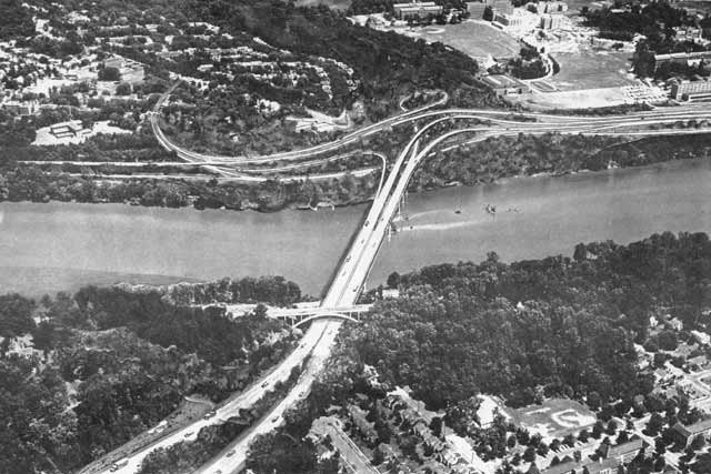
Proposed I-266 Three Sisters Bridge
looking from Virginia to Washington, D.C.
with Georgetown University at upper right.


... Peter Craig, a junior lawyer at the prestigious firm of Covington & Burling. Craig had come to Washington after graduating from Yale Law School in 1953.

In September 1966, following the N.C.P.C. vote, the Committee of 100 resolved to file a law lawsuit against the D.C. government and the N.C.P.C. to block [3 Sisters] bridge construction. Peter Craig, acting for the committee, turned to his former law firm, Covington & Burling. Partner Gerhard Gesell agreed to take the case for a nominal retainer and assigned lawyers Roberts Owen and Gerald Norton to the matter. Owen, the lead counsel, had paid little attention to the highway fight, but he enjoyed suing the government to force it to obey the law.

p 41 and 125 The Great Society Subway by Zachary M. Schrag


   Proposed I-95 B&O North Central Freeway next to Catholic University of America


Covington & Burling


Read About the Committee of 100's opposition to US NCPC's Extending the Legacy

Committee of 100 Ruminations


Frederic Delano 'Family' : U.S. NCPC, Committee of 100, and Covington & Burling


Subverting the North Central Freeway

Physical Realities Undermining the North Central Freeway

A Sampling Of Attitudes Towards D.C. I-95

Monday, November 24, 2008

Eastern SE Freeway Bastardization

Simply converting the eastern portion of the SE Freeway to a boulevard increases vehicular-pedestrian conflict, and is totally unnecessary, as evident from the cross sections in the Middle Anacostia Transportation Study, seen here [warning- PDF] at page 35 "Boulevard Typical Section #2 - Looking East towards Barney Circle".


Evidently the topography favors covering over the existing freeway, with the new boulevard atop; not shown is the idea of covering the RR nor extending the cover towards the Anacostia River with a terrace/staircase, as already done at the Lincoln Memorial. As this involves covering the existing freeway -- IOW no new depressing -- this is a comparatively cheap freeway under-grounding, unlike say this freeway to the west between the 11th Street and 1th Street Bridges.

The idea of covering the segment of this freeway between 14th and 15th Streets SE appeared in this late 1960s illustration seen here.

Continuing this cover westerly requires removing the elevated approaches to the 11th Street Bridges, something that I propose with a replacement with below grade approaches that would conflict with the existing heavy RR, though compatible if converted to vehicular traffic or lighter rail which can tolerate grade changes upwards of 5% whereas heavy RR can only tolerate a 1% grade. As with the highway, this railroad right of way is coverable.

Continuing this cover easterly to Barney Circle would be feasible with allowances for the ramps.

Likewise, the topography allows such a relatively easy under-grounding for this freeway's needed extension to RFK Stadium- East Capitol Street, and is fully compatible with planning for a slow speed waterfront boulevard atop, including the idea of a traffic circle at Massachusetts Avenue SE. Here to the railroad should also be covered.


Only those promoting a mindless ideology against urban freeways -- alas those traditionally in control of the governments -- would rather place all of this vehicular traffic upon the surface waterfront boulevard.

Saturday, March 17, 2007

I-295 East Leg to East Capitol Street and the SE Freeway at Barney Circle


East Leg

East Leg North Mt. Olivet Road NE Tunnel
DeLeuw, Cather, with Harry Weese "District of Columbia Interstate System"
November 1971

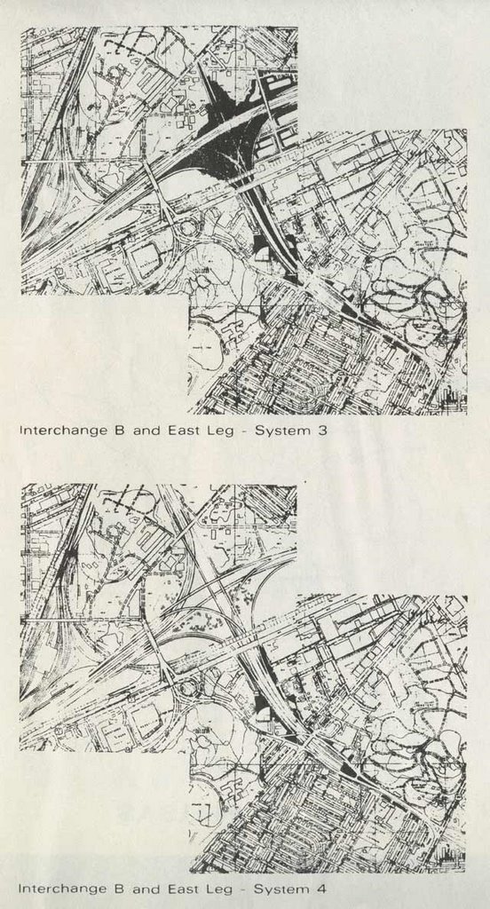
East Leg North Options
DeLeuw, Cather, with Harry Weese "District of Columbia Interstate System"

November 1971

DeLeuw, Cather, with Harry Weese "District of Columbia Interstate System"
November 1971

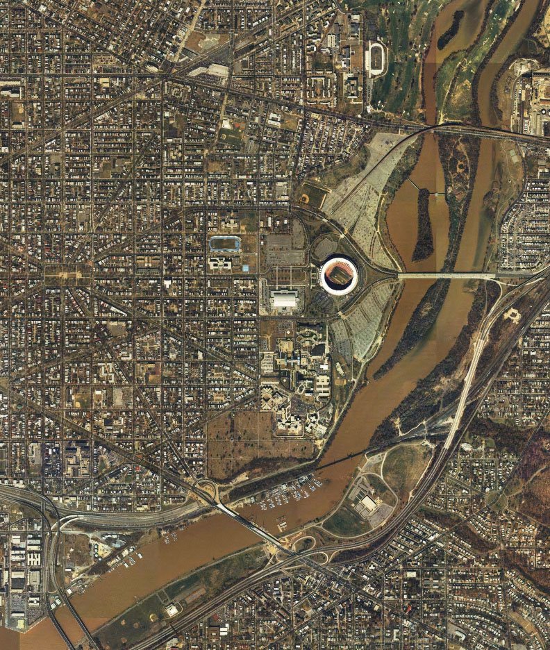
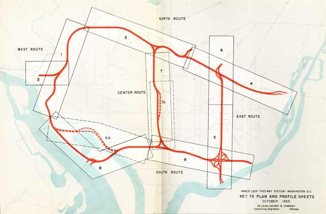
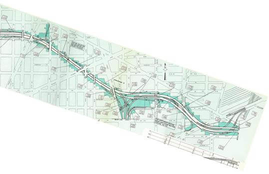
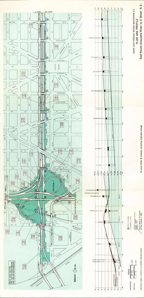
The East Leg to East Capitol Street appeared about 1963 in response to public opposition to the preceding East Leg route proposals along 11th Street NE/SE that appeared in the 1955 Inner Loop Study. To see this earlier East Leg route, see plates 5 and 6 at 1955-62 Plans. Today's 11th Street Bridges in effect are the southern extension of this un-built north-south cross-town land route.

1961


1955


1955


Image produced by National Capital Planning Commission for the Washington Geographic Information System. Distributed by VARGIS LLC of Herndon, VA.

The East Leg to East Capitol Street would have included an interchange with the East Capitol Street Whitney Young Memorial Bridge. From there it would have continued south, roughly paralleling the western side of the Anacostia River to turn east to connect directly with the SE Freeway underpasses beneath Barney Circle.


Friday, December 01, 2006

1955-62 Plans

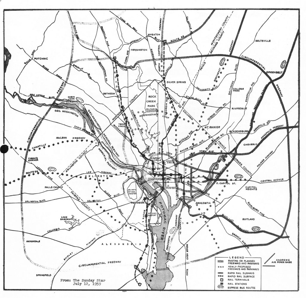
1959 Mass Transportation Plan

1955 Inner Loop Freeway Proposal


1955 Inner Loop Freeway Proposal Guide to Plates


Plate 1


Plate 2


Plate 3


Plate 4

Plate 6


Plate 5


Plate 7

Plate 7A


Plates 9a and 8
W

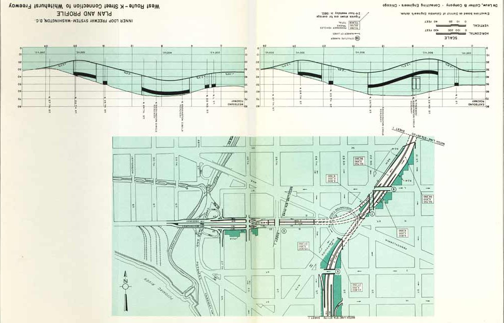
1955 Inner Loop Whitehurst - West Leg Interchange


1955 Inner Loop North Leg - East Leg Interchange

North Leg West


North Leg East


SW Freeway


1957 design West Leg interchange


1957 Route 240 Northwest Freeway
along Georgetown waterfront


1957 Route 240 Northwest Freeway
at Chain Bridge


I-66 North Leg West with dotted lines indicating I-70S at 14th Street and the North Central Freeway at Sherman Avenue (note the tight spacing between these interchanges!)


1959

part tunneled east-west Cleveland Park I-70S segment-
west of Rock Creek Park


open depressed Mt. Pleasant I-70S segment-
east of Rock Creek Park


1960

This 1960 I-95 route could feed directly into the I-295 East Leg along 11th Street NE/SE.


1961

A 1961 rendering of the SW/SE Freeway, with unadopted route for SE Freeway along southern side of railroad.

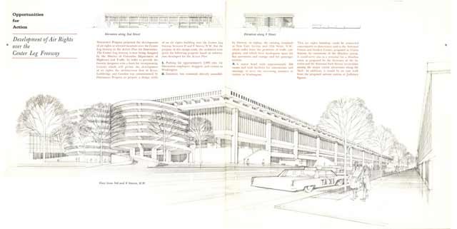
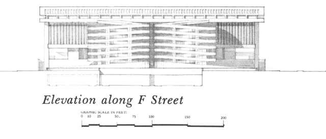
A 1961 rendering of a proposed parking garage atop the Center Leg at F Street NW