Freeway cover (otherwise known as lids caps or decks) can block noise and pollution and reclaim land, yet the powers that be would rather push the burden away- as the Washington D.C. area reveals
As
a historian of the Washington, D.C. freeway system, having made numerous observations
as these, I have found surprisingly little if anything about the position of the two most important holders of property along D.C. I-95's most logical route: Catholic University of American, and the Masonic Eastern Star Order.
In particular I have yet to see anything about their position on the concept of the segments of freeway alongside the RR next to the former's campus, nor directly through the latter's Home property at 6000 New Hampshire Avenue NE, being covered - effectively reclaiming land providing space for various local amenities - while suppressing noise and potentially with emissions, particularly if properly ventilated and filtrated.
1966 Supplementary Study North Central Freeway alongside Catholic University of America
Note how this shows the area alongside the main CUA campus as covered as far north as Taylor Street.
1971 North Central Freeway
Note how this extends the cover further south to Rhode Island Avenue yet deletes the northern segment alongside the main CUA campus. While I have found a reference to the CUA heirarchey being officially neutral about the North Central Freeway itself, I have yet to see any reference to any such position on the cover, and its disappearance in the area alongside the main CUA campus.
1971 Northeastern Freeway PEPCO-B&O Route through the property of the Masonic Eastern Star Home at 6000 New Hampshire Avenue.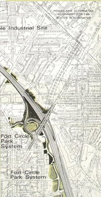
1971-1973 I-95 PEPCO Overview
http://wwwtripwithinthebeltway.blogspot.com/2006/11/pepcobo-i-95.html1973 I-95 PEPCO Maryland Report
http://wwwtripwithinthebeltway.blogspot.com/2009/06/1973-pepco-i-95-extension-inside.htmlI have yet to find anything about Masonic Eastern Star, say demanding that this segment be built as a cut and cover tunnel, prior to the cancellation of this 'PEPCO-B&O' route by Maryland, announced in July 1973
Stopping D.C. I-95 had its undeniable spill-over effect upon that segment of the I-495 Capital Beltway where the consequently missing I-95 gap was re-signed onto; that segment includes the Beltway's southern crossing of the Potomac River: the Woodrow Wilson Bridge. During the 1990s planning started upon the project to replace the existing 6 lane bridge with a pair of 6 lane bridges with corresponding wider approaches. As mitigation, this project was to include a cover atop a portion of this I-495 approach in Virginia; this cover or lid or cap was to be known as the Washington Street Urban Deck.
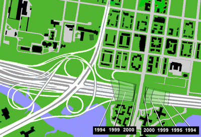
I would though find yet another expression of indifference to highway mitigation within the political halls at Alexandria, Virginia with their 11th hour deletion of most of the Washington Street Urban Deck that had been proposed to cover a 1,100 foot long segment of the I-495 Capital Beltway there.
Alexandria, Virginia Backroom Sell Out
http://wwwtripwithinthebeltway.blogspot.com/2007/03/what-could-have-been-said-backroom.htmlWhat Others in Alexandria Got From Stealing the Urban Deck
http://wwwtripwithinthebeltway.blogspot.com/2007/03/what-others-got-from-siphoning-urban.htmlRubber Stamp U.S. NCPC March 2001
http://wwwtripwithinthebeltway.blogspot.com/2007/03/what-others-got-from-siphoning-urban.htmlRubber Stamp U.S. NCPC November 2001
http://wwwtripwithinthebeltway.blogspot.com/2007/03/how-things-went-at-us-nati_117295465376800441.htmlThe Woodrow Wilson Bridge Stakeholders' Participation Panel on the Route 1 interchange and the Washington Street Urban Deck on August 26, 2000, overwhelmingly REJECTS proposal to shorten the deck
http://wwwtripwithinthebeltway.blogspot.com/2007/02/spps-august-26-2000-rejection-of-deck_13.htmlThe Alexandria City Council Lies Through Its Teeth- pretends that the August 26, 2000 meeting never occurred
http://wwwtripwithinthebeltway.blogspot.com/2007/02/what-happened-at-alexandria-city-hall.htmlPromote a Good Idea- Alexandria then goes in reverse
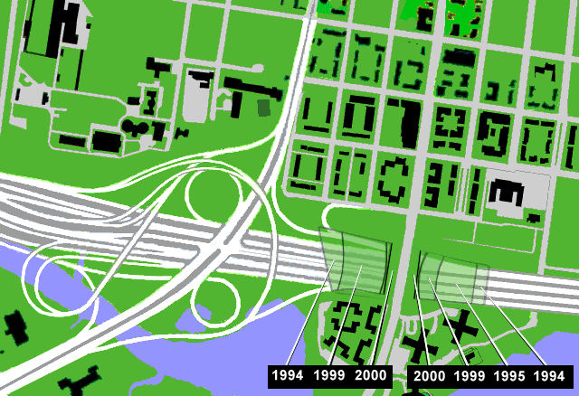
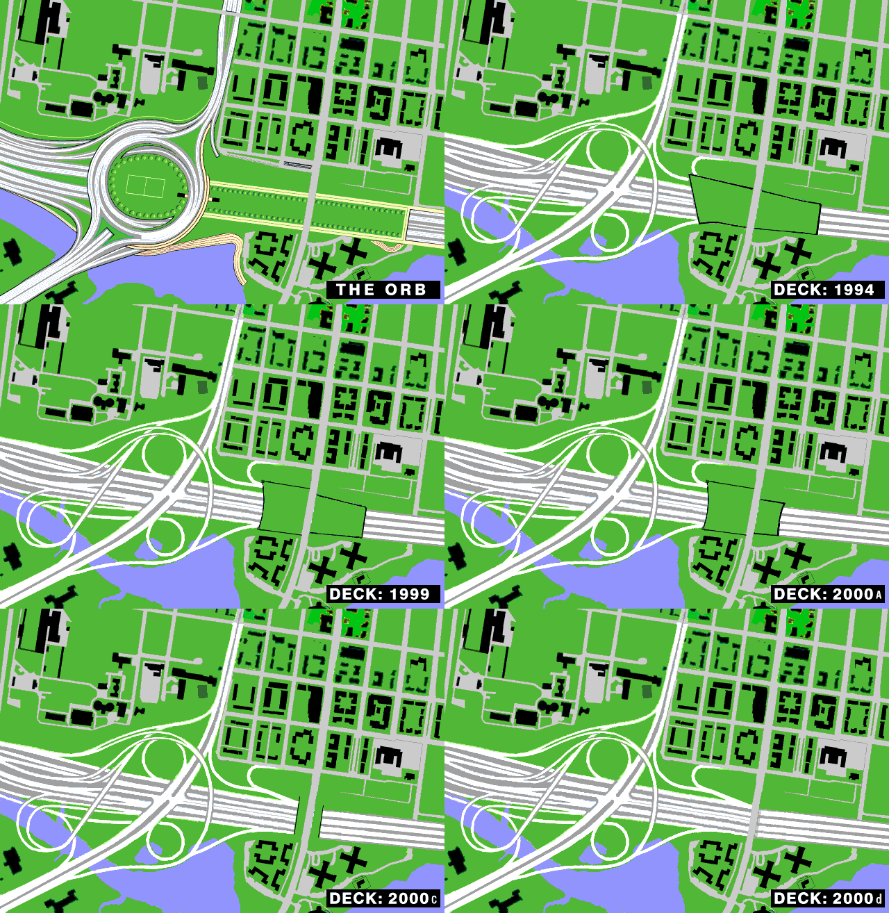
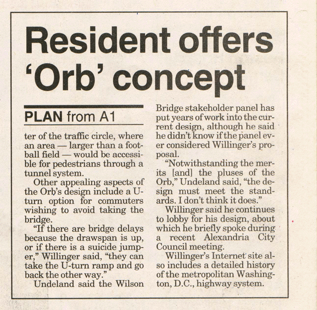
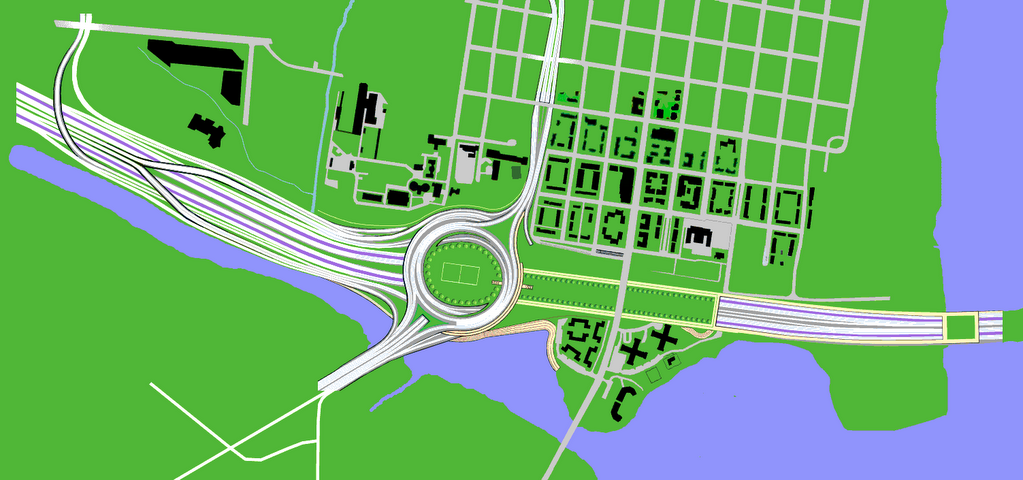
http://wwwtripwithinthebeltway.blogspot.com/2007/02/alexandria-chop-job-on-urban-deck.htmlThe Shrinking Washington Street Urban DeckMy Alexandria Orb Proposal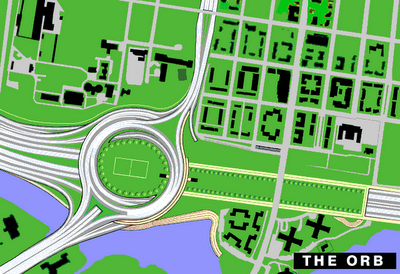

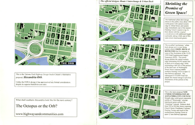
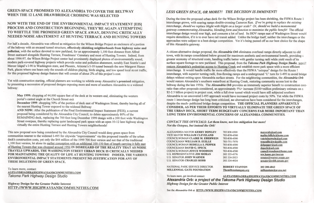
Alexandria Orb brochure
showing successive shrinkage of the proposed Washington Street Urban Deck
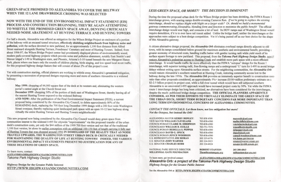
reverse
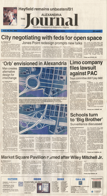
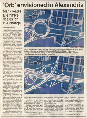
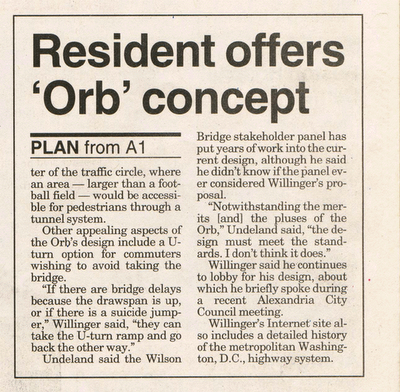
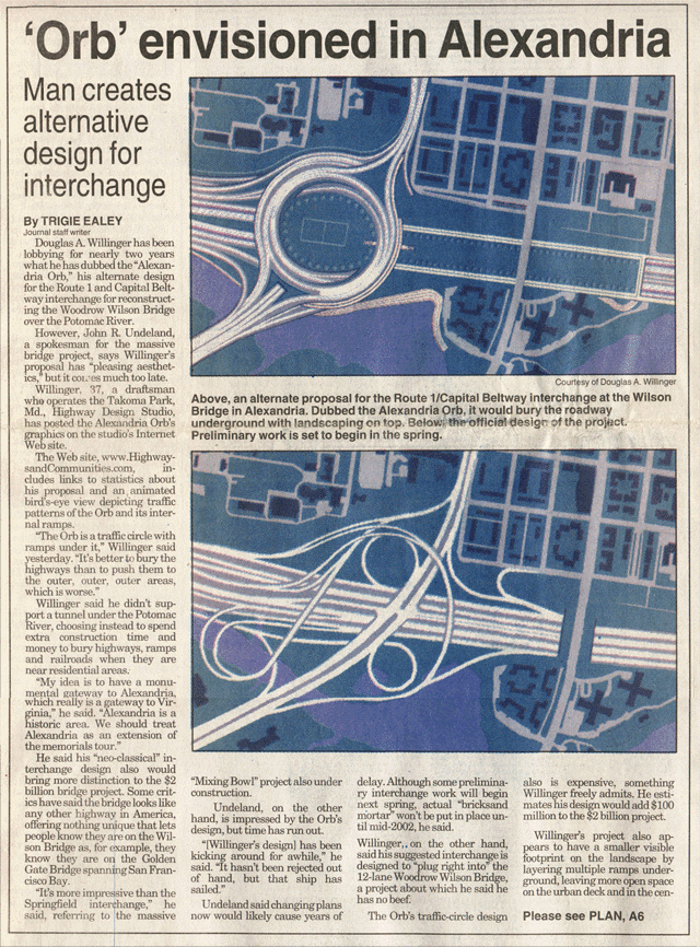
The Alexandria Orb proposal was page one news, December 18, 2000 upon the Alexandria Journal and the Fairfax Journal.
Yet reaction within Alexandria, from my own observations were either of support or a stony silence- the latter tending to include the entire Alexandria City Council.
All of them would simply rubber stamp the deletion of some 80% of the proposed Washington Street Urban Deck, leaving places such as a restored Freedmen's Cemetery directly next to not parkland but instead an exposed 12+ lane segment of I-495: a decision that would be incredibly supported by every single established organization within Alexandria, accepted without any apparent debate, nor discussion, and all accepted unanimously.
AFIAK, publically, neither of the two most important property holders along this route, that of the George Washington Masonic Tower -- Alexandria's tallest buildings festooned with a giant compass and square -- and of St Mary's, immediately next to the I-495 approach to the Wilson Bridge[s] expressed any apparent interest in these decisions.
Nonetheless, all of this without debate, unanimous sort of political behavior may bespeak the dynamics of being yoked via membership into such fraternal entities, such as those found within the vast empire of organized Masonry.

Just shut up and be another jolly good fellow (yes man),
given an overpriced job as reward for loyalty and mediocrity.

George Washington Masonic Memorial,
Alexandria, Virginia's tallest building
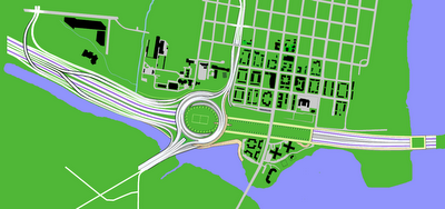

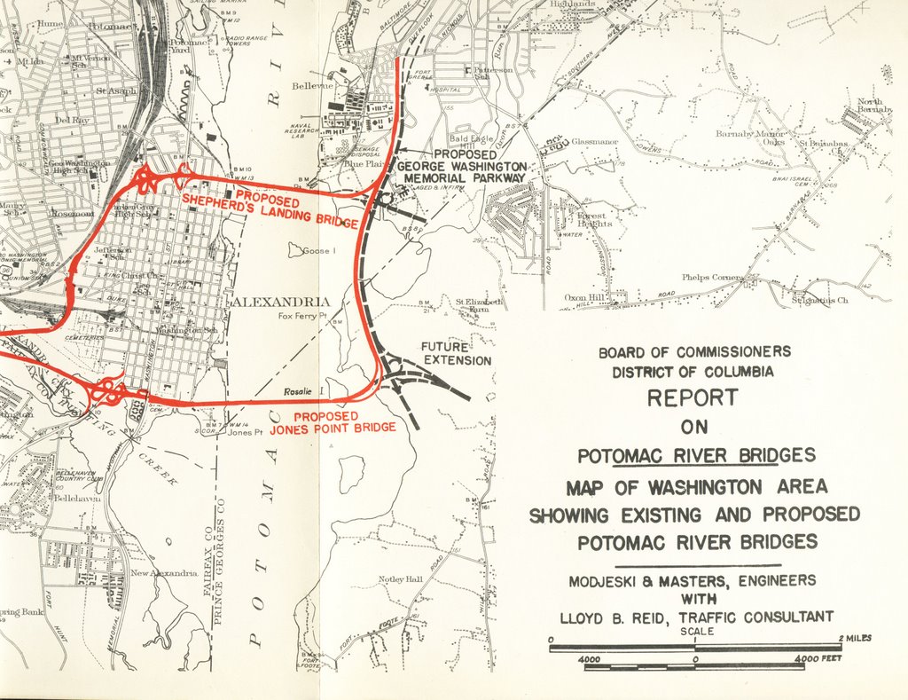
1952 proposal in area of Alexandria, Virginia,
with George Washington Masonic Memorial Tower at left
 Washington, D.C. Mayor Adrian Fenty's ceremony on project that has its northwestern end overlap with USNCPC's recent I-395 Washington Channel Tunnel