Sunday, March 08, 2009

Washington, D.C. Unanimous Cave In On Route Chock

D.C. City Council votes unanimously to subvert transport corridor chock in total violation of post 911 evacuation route concerns, approving 'Brookland Small Area Plan' that shoehorns development to even block adding a single northbound track.


From Greater, Greater, Washington:

http://greatergreaterwashington.org/post.cgi?id=1747

The DC Council's Committee of the Whole approved the Brookland Small Area Plan this morning. Technically, they just placed a resolution on the calendar to approve the plan, with some comments; the full Council will vote on the plan later today. However, after this vote, final passage is overwhelmingly likely. Update: The plan passed unanimously.

David-

What was the vote? Was it unanimous or was their some diversity of opinion, debate??

by Douglas Willinger on Mar 3, 2009 11:34 am (link)

Unanimous on a voice vote.

by David Alpert on Mar 3, 2009 11:41 am (link)


That's some government.

That is utterly consistent with my experience when I was promoting the Alexandria Orb and the preservation of the proposed Washington Street Urban Deck.

It was proposed to cover 1,100 feet of the Beltway but which was cut back by some 80% to trade away the funds for things as prettier sidewalks along and around the Prince Street area, voted unanimously by the Alexandria City Council in Dec 2000 and by USNCPC in March 2001.

http://wwwtripwithinthebeltway.blogspot.com/2007/02/what-happened-at-alexandria-city-hall.html

http://wwwtripwithinthebeltway.blogspot.com/2007/03/what-could-have-been-said-backroom.html

http://wwwtripwithinthebeltway.blogspot.com/2007/03/what-this-was-outcome-of-highly.html

http://wwwtripwithinthebeltway.blogspot.com/2007/03/rubber-stamp-resolution-by-us-national.html

http://wwwtripwithinthebeltway.blogspot.com/2007/03/what-others-got-from-siphoning-urban.html

http://wwwtripwithinthebeltway.blogspot.com/2007/03/how-things-went-at-us-nati_117295465376800441.html

See more at my blog 'A Trip Within the Beltway' under the tag "Alexandria Orb"

by Douglas Willinger on Mar 3, 2009 12:00 pm (link)

Sunday, March 01, 2009

D.C. Transportation Led By Jesuitical Traitors

4 decades ago doctrinaire anti freeway activists cried out for canceling all of the un-built highways to 'give rail transit a chance', resulting in some of the worst transportation problems within the U.S.

Now they want to spend millions on slow speed street trolleys, while sanctioning haphazard real estate development to block transport corridors, subverting commuter/evacuation routes, blocking even adding rail capacity.

Our government, including the so-called Defense Department, must be led by traitors...

From Commuter Outrage:

Streetcars Are Stupid, And So Are Our Leaders

by Lewis Derkins
February 28th, 2009, 12:05 am
Metro Employees Hard at Work
Metro Employees Hard at Work*
[*my caption would have it as planners who seek to chock transport corridors]

This morning I slogged along to work on the Metro as usual. For some reason, it takes me half an hour to make a trip that takes five minutes in a car, but the upside of this inconvenient delay is that I get to read the Express.

For those unfamiliar with this publication, it’s basically a cliff notes version of the day’s big news events. On page 9 of today’s issue, a headline jumped out at me – “Metro Scours for Revenue”.

This article dutifully informed me that my ride was probably going to become more miserable since Metro is considering “cutting costs and changing services” – read: “cutting services” – to close a $28.8 Million budget gap.

The surprising thing about this announcement is that I read about a DC Department of Transportation plan to announce the revival of streetcars in the district to the tune of $25 Million the previous day.

I’ve talked about this streetcar project before and, spoiler alert: I’m not a fan.

The line is supposed to run a little over 2 miles from Anacostia Metro to Boling AFB. This is idiotic for several reasons including the cost, the limited service and the lack of need.

The streetcars are a part of the Anacostia Waterfront Initiative which is supposed to revitalize Anacostia. New flash – if you want to revitalize Anacostia, crack down on the crime. No tourists are in a hurry to ride your pretty streetcars from nowhere to nowhere else with the threat of being shot looming over their heads. And FYI, tourists are the only people who are going to ride this thing.

The idea that Streetcars are going to lead to an urban renaissance is a fairy tale. Let’s be honest about streetcars, they’re something in between a half-assed Metro, and a glorified bus. They’re not as good as Metro because they’re above ground, running on the street, so they don’t protect riders from the elements (just like buses), and they have to travel at the prevailing speed of traffic (and are consequently subject to traffic delays). They’re admittedly prettier than busses, but they don’t have the ability to change routes. If we find out that the line we’ve laid out isn’t necessary, well, oops! Looks like we laid tracks in the street and we’re screwed. At least a bus can be easily rerouted to an area where it’s needed and it doesn’t require any new infrastructure.

But let’s not get too far off track here, why are we spending $25 million on something completely unnecessary when the Metro, which services Anacostia and the surrounding neighborhoods, needs $29 Million? We could give that streetcar money to Metro and alleviate a huge part of the budget shortfall problem.

For Metro’s FY09 Budget, DC gave $295.2 Million, or roughly 16% of the total budget. There is good reason for this, Metro maintains the second largest rail system and the fifth largest bus system in the nation and a huge proportion of its riders are federal government employees.

Why isn’t DC giving this streetcar money to Metro to do something useful with it (the merits of how useful Metro’s actions would be are concededly up for debate) instead of frittering it away on something that looks nice but provides very little real value? And why the hell isn’t the Metro Board of Directors screaming bloody murder about this proposed boondoggle?

Maybe I should be realistic about this, when half of your board of directors rarely even use the system it really isn’t any wonder that they’re out of touch.

A big thanks to the hard-hitting journalism at the Express for not highlighting this stupidity. Perhaps they were just too busy trying to come up with a witty quip for their next headline to bother focusing on something like real journalism.

Thanks also to the average brain-dead DC resident [or hold one's finger up to the wind careerist suck up] who fails to say anything to prevent this buffoonery. Maybe I’m asking too much though. For someone to notice this they’d have to have an attention span longer than 30 seconds and an interest in something other than American Idol so they would 1) read both stories and 2) actually be able to remember the contents of the stories and connect the dots. While we’re at it, thanks public school system for ingraining a sense of intellectual curiosity and civic responsibility in our nation’s future leaders. Bang up job!

We should paint the Metro like a bunch of clown cars and start to play circus music over the intercom in all the stations. We should apply this same technique to the DC DoT offices downtown. What’s the next step in our bright transportation future you clowns, rickshaws or pony rides?

Posted in Uncategorized Rage | No Comments »


Sunday, February 22, 2009

Virginia's Inside the Beltway Corridor Chock Epidemic

It's not only within D.C. where railroad industry personal subvert highway competition

- spot improvement project was to add an axillary lane between on and off ramps in the westbound direction to better serve local traffic, yet do nothing about the infamous eastbound I-66/Dulles Access 267 merge


http://groups.google.com/group/misc.transport.road/browse_thread/thread/967fed697fa6831e/38da3d7b52ee5607?hl=en#38da3d7b52ee5607
" type="hidden">


Oscar Voss
View profile
More options Feb 21, 3:09 am
Newsgroups: misc.transport.road
From: "Oscar Voss" ...@comcast.net>
Date: Sat, 21 Feb 2009 03:09:41 -0500
Local: Sat, Feb 21 2009 3:09 am
Subject: VA - I-66 "spot improvements" in limbo
The Metropolitan Washington Council of Government's Transportation Planning Board voted this week to remove three proposed "spot improvements" to westbound Interstate 66 inside the Capital Beltway from next year's transportation improvement plan. Work on the first project, to create a westbound auxiliary lane connecting the Fairfax Drive on-ramp to the Sycamore Street off-ramp (that stretch is one of the worst off-peak chokepoints), would have started next year.

This decision was supposedly driven by VDOT's failure to fully fund a $15 million study of transportation alternatives in the I-66 corridor. VDOT points out, however, that the projects were never tied to completion of that study. My sense in any case is that the expensive and time-consuming study ($15 million and three-four years, as a precondition for projects totaling about $75 million which have already been talked about for ages, seem disproportionate) was sought as a stalling tactic, by people (lots of them in my Arlington County, including the county government) who will be dead set against the projects no matter what the study ends up concluding.

This decision could be revisited later, but VDOT seems resigned to having the projects put on hold for a few more years.

"Vote to Forgo I-66 Expansion Imperils Federal Funds, Increases Ire,"
http://www.washingtonpost.com/wp-dyn/content/article/2009/02/19/AR200...

see also:
http://voices.washingtonpost.com/getthere/2009/02/i-66_spot_improveme...

--
Oscar Voss - oscar.v...@comcast.net - Arlington VA

my Hot Springs and Highways pages: http://home.comcast.net/~oscar.voss/
Hawaii Highways: http://www.hawaiihighways.com/


Friday, February 20, 2009

D.C. Corridor Chock Epidemic

Contempt of the Medievalists

The proposed DC CUA-Brookland Small Area plan is not the only threat to major transportation corridors within Washington, D.C., particularly regarding or connecting to the built and un-built I-395.

Here's is a list of the most infamous transgressors:

Capital Square Townhouses
I-395 SW Freeway bottleneck pinch


Eakin-Youngentob "Capital Square" townhouses, on land plot between 6th, 7th, G Street SW and the SW Freeway, with row of 28 townhouses a mere 16 1/2 feet from SW Freeway retaining wall, one block south of the U.S. Department of Housing and Urban Development. This 16 1/5 foot setback is significantly less then that of all of the other buildings along the southern side of the SW Freeway, which have 70-90 feet of setback.

This makes it more difficult and expensive to construct new retaining wall for tunnel roof (as the existing walls would not be likely to be so designed), hence keeping the existing SW Freeway in a configuration that divides DC SW - hence contrary to long term NCPC planning for the removal of the mass of elevated highways and railways that now cross over South Capital Street. This also makes it more difficult and expensive to improve safety and decrease congestion and pollution with mitigating the SW Freeway bottleneck southwards and westerly of the Center Leg -- hence more likely remaining a traffic bottleneck with ripple effects well into Virginia.

Increased costs required for Eminent Domain and Demolition for row of 28 townhouses : $30 million.

Increased costs required for obtaining construction staging area elsewhere, and for required extra construction equipment trips on local streets: $10 million by denying a logical staging area for achieving the long touted goal of constructing a new monumental replacement "14th Street Bridge"

http://wwwtripwithinthebeltway.blogspot.com/2008/07/takoma-dc-tranport-chock-developer_4323.html


Golden Rule Apartment
I-395 Center Leg (3rd Street) Tunnel on ramp blockage

Placing senior citizens in new apartment house that blocks the 2nd Street NW I-395 northbound tunnel on-ramp, placing greater traffic on a New Jersey Avenue where it established new migratory pattern of senior citizens carrying their groceries from food market owned by the same entity owning this apartment building.

Blocks currently unused on ramp built as a part of the 1978-82 3rd Street Tunnel north of Massachusetts Avenue for later use, hence increasing traffic load upon New Jersey Avenue north of K Street.

Establishes a migratory pattern of elderly pedestrians carrying groceries across New Jersey Avenue with its increased traffic load, with this new "Golden Rule" apartment building on the west side of New Jersey Avenue, with the closet grocery store being the "golden Rule" Market 1-2 blocks east.


Capital Gateway
I-395 NY Avenue Alternative Tunnel blockage

None of the official studies address the practicalities of constructing a tunnel directly beneath heavily traveled NY Avenue rather then partially alongside in undeveloped land, particularly at the spit where the existing cross RR bridge lands in the vicinity of Florida Avenue. Building beneath open adjacent land by definition will be less disruptive to traffic, yet officials say nothing about preserving an easement alongside New York Avenue, first with the Fed Ex building to the north, and now this project to the south.

http://wwwtripwithinthebeltway.blogspot.com/2008/08/washington-gateway-chock_11.html


CUA-Brookland Area Small Area Plan
North Central Freeway Tunnel Chock

This blocks any multi-modelization of the Metropolitan Branch RR other then the multiple level stacked elevated concept proposed in 1965.

http://wwwtripwithinthebeltway.blogspot.com/2009/02/what-obama-must-do-for-transportation.html

http://wwwtripwithinthebeltway.blogspot.com/2008/05/cuabrookland-transport-corridor-chock.html

Takoma Metro Area: Elevation 314, and Cedar Crossing DEATH TRAPS
North Central Freeway Tunnel Chock

http://wwwtripwithinthebeltway.blogspot.com/2011/11/takoma-dc-death-trap-residential.html

New residences in wood framed structures within 15 and 45 feet respectively of elevated heavy freight RR, largely within the footprint of a potential RR derailment, tumbling downward.


Tuesday, February 03, 2009

What Obama Must Do For D.C. Transportation Security

Official planning to chock northern Washington, D.C.'s sole grade separated ground north south transportation corridor, subverting valuable evacuation route


Left: Brookland Metro station area today. Image from Google Maps. Right: Metro station sub-area plan. (from article within Greater Greater Washington)

Corridor Suitable for Cut and Cover Railway - Highway Tunnel, yet official planing sells out to real estate development

Chocks of the construction of the hugely useful North Central Freeway corridor, proposed by the Kennedy Administration in November 1962, but hugely botched with a 1964 engineering study that routed the highway needlessly through neighborhoods.


North Central B&O Metropolitan Branch RR corridor midway between Potomac and eastern Capital Beltway. (shown with I-95 Northeast Freeway via the Fort Drive - Northwest Branch Route).

1962 Kennedy Administration plan with WMATA and B&O Route North Central Freeway


1964 North Central Freeway engineering study deviates seriously from the 1962 Kennedy proposal, officials considered this until the late 1960s as a 'cheaper' alternative
to the 1962 concept featured in the
supplementary North Central Freeway study report of 1966


1971 North Central Freeway
with I-95 Northeast Freeway via the Fort Drive - Northwest Branch Route,
with cut and cover tunnel segment
from Rhode Island Avenue to north of Monroe Street NE
displacing 34 existing houses
with new development and parkland

My preference is for a new multi model transportation tunnel -- upgraded railways and new highway -- beneath a new linear urban park- the Washington, D.C. Grand Arc

Inside the Beltway I-95:
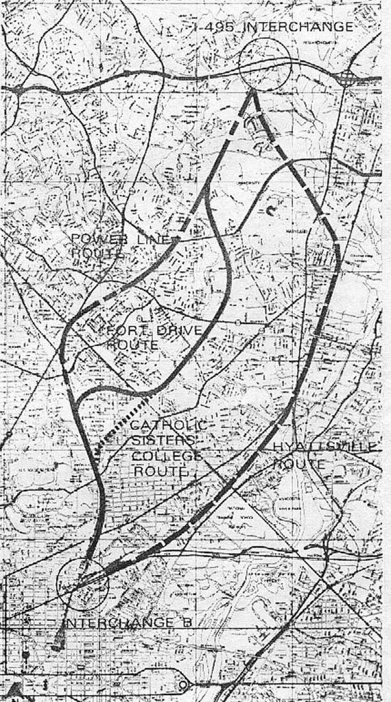
1971 PEPCO Power Line -B&O
1964-73 Northwest Branch Park - Fort Drive - B&O
1960 Northwest Branch Park - Catholic Sisters College - B&O

PEPCO-B&O offers greatest serviceability and least displacement
with greatest use of existing corridors.

Yet this is all often poorly reported.

Washington, D.C. FICTITIOUS I-95 Route

Brookland CUA Area Small Area Plan

Public Hearing Notice


Saturday, January 24, 2009

A TRIP WITHIN THE BELTWAY 101

D.C. Freeway Schematic:

A basic introduction to Washington, D.C.'s truncated freeway system

Illustration: Capital Beltway with Inner System, 1971 plan
with I-95 Northeast Freeway via the Fort Drive - Northwest Branch Park route

The Washington, D.C. area’s best known road is probably that which essentially circles it, the I-495 Capital Beltway.

Washington, D.C.’s main freeways are the upside down ‘T’ of the SW-SE Freeway and the north south Center Leg, and the short stretch of I-66 which enters D.C. via the Theodore Roosevelt Bridge before heading north to end in the vicinity of the Watergate complex.

Washington, D.C.’s freeway system is highly truncated with most of it unbuilt, as marketed by numerous truncations with the northern and southern ends of the Wet Leg, the north end of the I-395 tunnel at New York Avenue, the western end of the SW Freeway at Maine Street and the eastern end of the SE Freeway at a set of underpasses beneath Barney Circle at Pennsylvania Avenue SE. These freeway segments were planned as components of Washington, D.C.’s currently uncompleted Inner Loop Freeway.

Today, the term “Inner Loop” often is used to described the ‘inner’ aka clockwise running direction of the Capital Beltway. But it was to apply it an inner loop system – a sideways figure 8 – as a hub of a system with radial spokes connecting to and to points beyond the Capital Beltway. It was to accommodate both today's Capital Beltway as well as an Intermediate Loop, as shown in the 1959 plan.

1959 plan with 3 separate northern radials

1955 Inner Loop

The Inner Loop Freeway components were planned to connect to the Capital Beltway, in Virginia with I-66 from the west, and I-95 from the southwest, and in Maryland with I-295 from the south, Route 50 from the east, and I-95 from the northeast, as readily apparent by the truncated roadways at the interchange with the I-495 Capital Beltway near Greenbelt.

Such unbuilt highways underwent significant routing and design revisions from the 1950s into the 1970s to satisfy concerns, yet were canceled outright to provide extra funding to construct the WMATA rail transit system. This is even as the transportation plans from 1962 and later included highways and the WMATA rail transit system.

1962 Railways and Highways


1971 Inner Loop system
with 1975 Virginia I-595 to National Airport
(Scott M. Kozel)

Notable amongst these design revisions to reduce local negative impacts were replacing the open trench western North Leg along Florida Ave and U Streets NW (and, east of New Jersey Avenue elevated), and 11th Street NE/SE with the K Street Tunnel and the Mount Olivet Road Tunnel with surface continuation to R.F.K. Stadium.


1955 North Leg West of the Inner Loop


1971 North Leg West of the Inner Loop

Elizabeth Rowe of the U.S. National Capital Planning Commission and opponent of the 1955 Inner Loop plan was an early promoter of the I-66 North Leg K Street Tunnel in the mid 1960s.

Washington, D.C. Freeways
Scott M. Kozel - Washington, D.C. Interstates and Freeways

I-495 Capital Beltway

Scott M. Kozel - Capital Beltway

Steve Anderson D.C. Roads

Inner Loop Components:

Built:

West Leg

SW –SE Freeway

Center Leg (3rd Street Tunnel)

Unbuilt:

North Leg - K Street Tunnel Alternative

East Leg

South Leg


Radials:

Built:

I-270 (Maryland)
Scott Kozel Roads to the Future

I-66 (Virginia)
Scott Kozel Roads to the Future

I-95 (today's I-395 and Route 1) 14th Street Bridges
Scott Kozel Roads to the Future

I-95 (today’s I-395) Virginia Henry G. Shirley Memorial Highway
Scott Kozel Roads to the Future

I-295/DC 295
Steve Anderson D.C. Roads

Baltimore Washington Parkway
Steve Anderson D.C. Roads

New York Avenue - 50 (theoretical I-66)

50 - unsigned I-595 (theoretical I-66) Maryland
Scott Kozel Roads to the Future


Partially Built:

Clara Barton Parkway

Unbuilt:

Virginia Route 1 Bypass

Virginia-Georgetown I-266 Crossing

I-70S Northwest Freeway

1959

I-70S/I-95 North Central Freeway – I-95 Northeast Freeway

1959

1960

1962

1963-64

1965

1966

1971

1971 - 1973: Replacing the I-95 Fort Drive NW Branch Park Route with the PEPCO power line Route

1964 North Central Freeway Highway Routing Mystery- making enemies for a far more destructive and longer route


1959


1959
I-70S at
Friendship Heights, at the Maryland-District line

The freeway system’s earliest opposition manifested itself in NW, particularly in the area of Georgetown where the Canal Road – Whitehurst Freeway extension and Glover Archibald – Three Sisters axis crossed, and to the north.

1958-59 I-70S Cross Park Freeway

That was even as most of the dwelling displacement was to Rock Creek Park's east, through Mt. Pleasant and the along 14th Street to the intersection with the I-66 North Leg of the Inner Loop at U Street.

1958-59 I-70S east of Rock Creek Park,
interchange with I-66

That these canceled freeways – indeed freeways in general to the west of Rock Creek Park – had less impacts then those remaining under consideration after 1960 led to increased political opposition to the east, as such routes as the original North Central Freeway roughly paralleling Georgia Avenue would displace considerable more dwellings.


Just imagine-
a North Central Freeway along the Georgia Avenue corridor
right by Howard University

Yet such routings were simply unnecessary.

Washington, D.C. fortuitously has its sole north south railroad industrial corridor -- the B&O Metropolitan Branch RR/ today's WMATA above ground Red Line -- about directly in the middle between the Potomac River and the Capital Beltway’s eastern portion. It could accommodate the existing railway, the rail transit that became WMATA, and freeway.

1960

The initial D.C. I-95 Northeast Freeway engineering study report issued in 1960, considered a variety of routings before settling upon a route preference of this railroad - industrial corridor which runs next to Catholic University of America.

1960

As such, this corridor was proposed to accommodate a generally below grade North Central Freeway routing serving both inside the Beltway I-70S (I-270) and I-95 , accommodating a spur for the latter to and from the north-east, via the Administration of John F. Kennedy in a report dated November 1962.

1962


1964

Nonetheless, that proposal would be seriously undermined by the subsequent initial North Central Freeway engineering study that issued its report in October 1964; that report altogether excluded the JFK B&O railroad route with an upwards of 37 route options with many running nowhere near the railroad corridor, and with a recommended route (#11) that ran partially along the railroad but with serious deviations away with far greater dwelling displacement in Brookland, D.C., notably with the Turkey Thicket neighborhood, and particularly within Takoma Park Maryland with 471 houses in a 1.1 mile segment.

1964

1966

By 1966 a supplementary engineering study adhered to the 1962 Kennedy concept proposal, however that was to be politically undermined by planning organizations and officials that waffle between the 1964 and 1966 plans on account of the earlier plan's lower construction costs due to its use of sloped embankments rather then retaining walls.

A 1971 design report would work to reduce local opposition by including a lid (cap) over a length of the North Central Freeway from a few hundred feet north of Michigan Avenue southward to Rhode Island Avenue; however it would in explicitly delete the idea of such a highway (and even railroad) cover northwards alongside the main campus of Catholic University of America to Taylor Street.

1966 Proposed Air Rights Area


1971


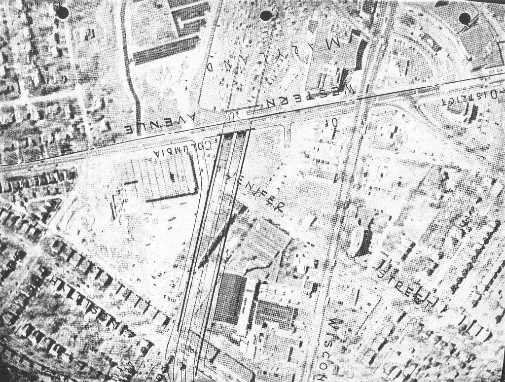
By 1971, with the planning refinements for reducing impacts, with the 1970 refinement of the I-95 North Central Freeway in the west Brookland area with a retaining wall (reducing the dwelling displacement from 69 to 34), along with the Inner Loop component substitutions, most notably with the I-66 K Street Tunnel, the overwhelming amount of dwelling displacement for completing the then proposed freeway system was the 1,048 or so for the North Leg’s central portion connecting the I-66 K Street tunnel east of Mt Vernon Square to the I-95 Center Leg and carrying I-95 northeasterly towards the interchange with the I-95 North Central – Northeast Freeway, the Route 50 (or I-66 eastern continuation) New York Avenue Industrial Freeway and the Inner Loop East Leg.

Of this, I48 were for the I-66 tunnel, 600+ for the I-95 North Leg, and 172 for the Mt Olivet Road tunnel area of the East Leg northern portion, with its southern portion and the New York Avenue Industrial Freeway taking 0, and the I-95 portion of the North Central – Northeast Freeway displacing 34 in D.C., and about 110 in Maryland, with the subsequent PEPCO route taking 0 in Maryland but about 25 just inside D.C. just north of New Hampshire Avenue.
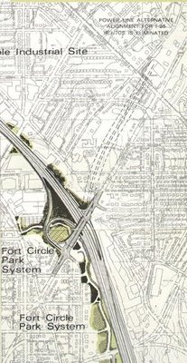
1971

I-95 PEPCO-B&O Route
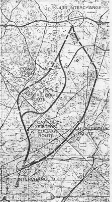

Inside the Beltway I-95:
1971 PEPCO Power Line -B&O
1964-73 Northwest Branch Park - Fort Drive - B&O
1960 Northwest Branch Park - Catholic Sisters College - B&O
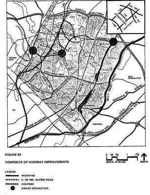

1973 PEPCO Power Line Inside the Beltway I-95
note sharper curve at New Hampshire Avenue

The popular anti-freeway battle cry would be “no white man’s roads through black mans; homes”.

Yet the most driven latter 1960s protesting would be for the I-266 Three Sisters Bridge in the vicinity of Georgetown University, and the I-95 North Central Freeway in the Brookland – Catholic University of American area.


This arrangement leaves a disproportionate amount of the through traffic burden in the less politically affluent D.C. SE, without extra environmental mitigation, in what may be sarcastically called "social justice".

Who Really Stopped Washington, D.C.'s Freeways

A Sampling of Attitudes Towards D.C. I-95

A Washington, D.C. Big Dig