Wednesday, April 04, 2007

I-66 West Leg Future?


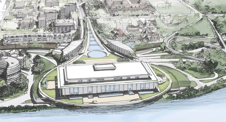
This proposed project would construct a deck over D.C. I-66 in front of the John F. Kennedy Center for the Performing Arts at the interchange with the E Street Expressway.

The concept appeared in the 1996-97 NCPC planning publications "Extending the Legacy: Planning America's Capital for the 21st Century" for "air rights" atop this segment of D.C. I-66.

The more recent study included numerous options, all of which treat it as a heavily truncated system.

The design reduces potential capacity to the south by placing its underground parking alongside rather then atop I-66 on its existing grade. (A proper below ground design would instead drop the I-66 grade to sandwich the parking between I-66 and the deck surface). Hence it includes no provisions for accommodating future extensions, at either end, whether for an I-695 South Leg (or conceivably a tunnel to Route 27 in Virginia), the previously planned I-66 K Street Tunnel, nor a deep drilled tunnel to the north, north-west, taking advantage of technological advances since, for a logically needed Northwest Freeway Tunnel.

This is despite calls -- or lip service -- from the federal government since September 11, 2001, for new evacuation routes from cities.

http://www.contextsensitivesolutions.org/content/reading/Kennedy_center/resources/kennedy_ea_summary/http://www.efl.fhwa.dot.gov/planning/kennedy/kennedy.pdf
http://testimony.ost.dot.gov/test/pasttest/02test/Peters4.htm


This project was recently de-funded.

Although clearly an improvement on the surface -- and representative of the proper concept of covering depressed highways -- it's underground portion needs extensive re-design to accommodate a comprehensive, primarily underground, Washington, D.C. motorway network.

DCist- Kennedy Center's Plaza Project Doomed?


Addendum- January 6, 2015:

Below is a design proposal - which is not my preference - from the "National Alliance to Restore Pride in America's Capital" (NARPAC) featuring a re-design of the I-66 West Leg to connect directly with the Rock Creek Parkway.


My preference would be partial ellipse park covered underground interchange somewhat akin to my Alexandria Orb proposal featured in the Alexandria Journal, connecting into a revived I-66 K Street Tunnel.


Tuesday, April 03, 2007

Whitehurst Freeway Future?

http://www.dickcorp.com/dickcorp/markets/images/projects/07_107.jpg

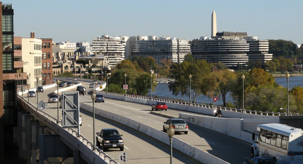
Constructed in 1947-49, the Whitehurst Freeway has two lanes in each direction and is not interstate highway design spec: for instance it lacks shoulders.

It has since been the object of various studies that would modify it.

One such study was the 1957 I-70S Northwest Freeway study, which included options that would have overlapped and hence updated the Whitehurst Freeway.

Another was a 1963 National Park Service proposal for I-70S along the Canal Road trolley right of way.

Others were all of the following I-266 proposals with the Three Sisters Bridge from the foot of Glover-Archibold to and through Spout Run.

All of these proposals would have at least doubled the Whitehurst's number of lanes from 4 to 8 while adding shoulders- hence resulting in a significantly wider facility.

This lead to a serious start at a look at building this new improved Whitehurst underground in 1965.

1965 Whitehurst Freeway Tunnel proposal

In 1968 consideration was given to the concept of replacing the proposed Three Sisters Bridge being proposed, with a Three Sisters Tunnel; it would also include connections to a Canal Road Parkway; this tunnel to Virginia concept was then promoted by the Committee of 100. It was abandoned by 1969 over concerns that its ascent grade for its Virginia approaches would be too steep for trucks, and IFAIK never re-introduced following the mid 1970s decision to ban suck truck traffic from the connecting highway, inside the beltway I-66.

With the public attention focused on how to "de-map" freeway projects to sped WMATA construction by a few months, tunnelizing the Whitehurst would not happen.


Reconstruction: 1990s

During the 1990s the existing Whitehurst viaduct was rehabilitated in two separate projects: one for its mainline; the other for its northernmost extremities.


And Now:


Whitehurst Freeway Deconstruction Feasibility Study

http://www.ddot.dc.gov/ddot/cwp/view,a,1249,q,624809.asp
http://www.ddot.dc.gov/ddot/cwp/view,a,1249,q,625355.asp


This includes at least one tunnel replacement alternative.

However, this study lacks any extended tunnel concepts that would take it further west past Georgetown University & Glover-Archibold Park.

Hence, the tunnel concepts now under consideration all share the same design situation of anything other then an elevated Whitehurst, of having to make that ascent/decent to connect with Key Bridge and Canal Road.

Most of the options under consideration are for simply no Whitehurst Freeway, with the traffic on M and K Streets, with the latter refashioned as a boulevard with traffic lights maximizing pedestrian-vehicular conflict, all in the name of removing the viaduct that now covers K Street. All of these surface options still have the topographical issue of how to make the ascent/descent connection to Key Bridge and Canal Road.

This boulevard concept is being promoted by the Committee of 100 on the Federal City and D.C. Councilmember Jack Evans.


Monday, April 02, 2007

D.C. 295- Kenilworth Avenue Corridor

Kenilworth Avenue Corridor Study
http://www.ddot.dc.gov/ddot/cwp/view,a,1249,q,620630.asp

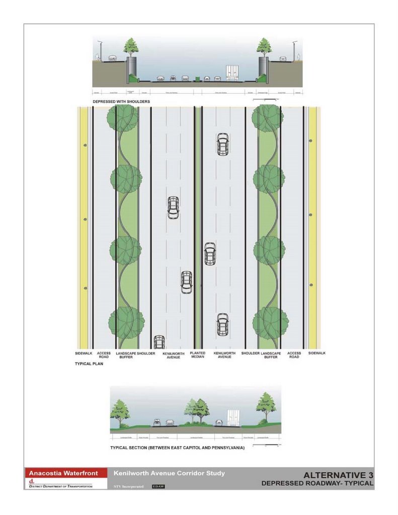
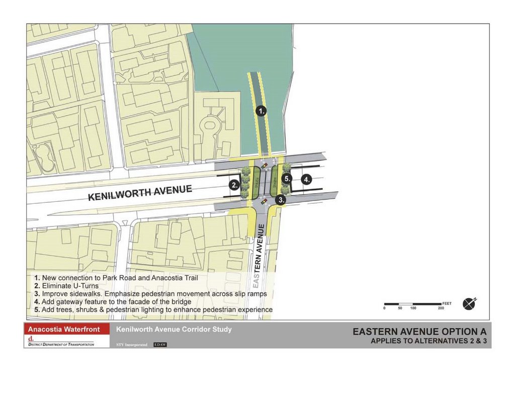
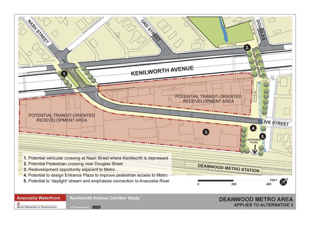
Alternative #3, a 6 lane depressed freeway increasing overall connectivity is one of three options considered by the Kenilworth Avenue Corridor Study. Although this includes short covered segments at Eastern Avenue and Douglas and Nash Streets, it fails to include options for extending these freeway "lids" into a longer cut and cover tunnel to maximize overall connectivity.

The other options are #2 for a surface freeway decreasing local connectivity, and #1 for a surface boulevard (with traffic lights) maximizing pedestrian-vehicular conflict.

Sunday, March 25, 2007

11th Street SE Bridges & Ramps


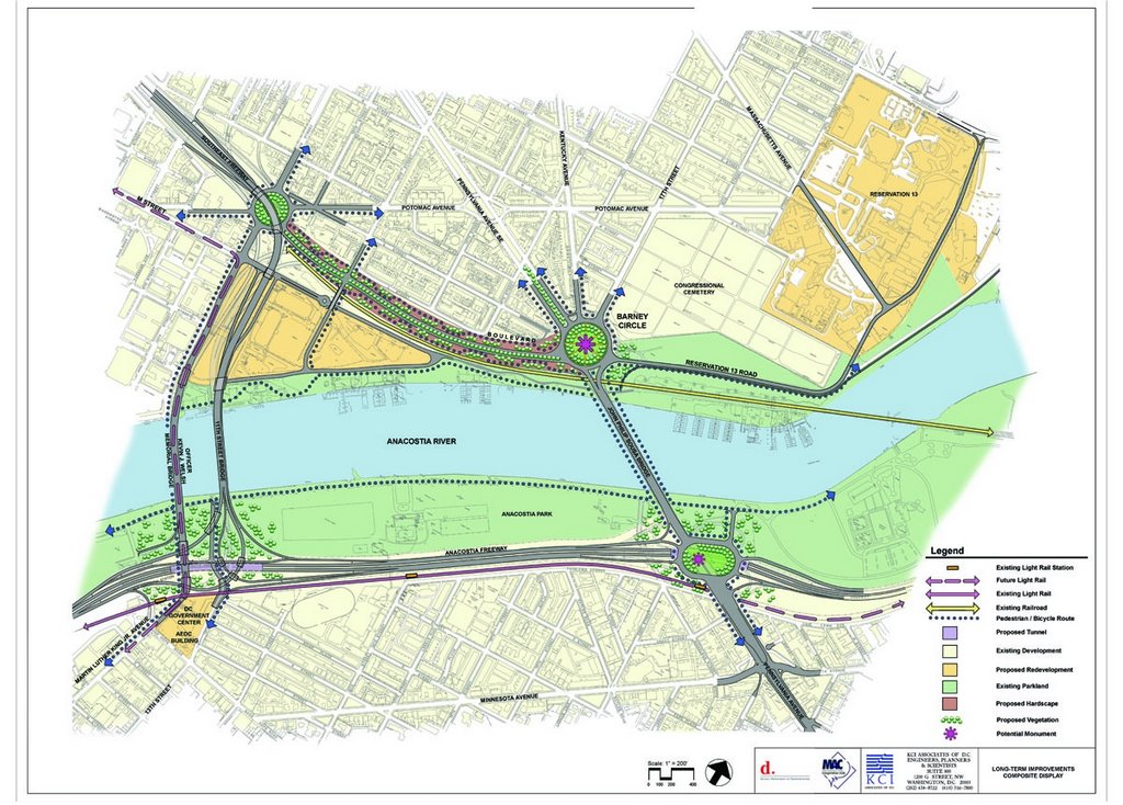
Subsequent planning at better connecting I-295 and I-395: building replacements for the 11th Street Bridge[s] that include full ramp connections at its southern end.

The existing 11th Street Bridge[s] were constructed during the 1960s.

These include full connections with the SE Freeway, both to the west (towards the I-395 SW Freeway and the I-395 Center Leg) and to the east (towards the East Leg to East Capitol Street.

They do not include connections with DC 295 to and from the north-east. That was because such traffic was to have a north-south North Central-Northeast Freeway as well as an east-west New York Avenue Industrial Freeway connecting to an I-66 K Street Tunnel.

http://www.ddot.dc.gov/ddot/cwp/view,a,1249,q,620301.asp
http://www.ddot.dc.gov/ddot/cwp/view,a,1249,q,627028.asp
http://www.ddot.dc.gov/ddot/cwp/view,a,1249,q,633384.asp

Opposition:

From the D.C. Sierra Club:
For years, DC residents have benefited from environmentally-friendly and community-sensitive planning by the District Department of Transportation (DDOT). Now, with their proposal their proposal to replace the replace the 11th Street Bridges, DDOT is proposing to spend up to half a billion dollars to add 50% more bridge capacity. The proposed project would destroy up to 12 acres of parkland and the Anacostia Community Boathouse. It would also effectively create an interstate highway shortcut through the District, adding thousands of cars and trucks to neighborhood streets each day and use up funding that could more effectively be spent on streetcars or bike and pedestrian saftey in our neighborhoods.

Read Sierra Club's comments on the Draft Environmental Impact Statement here.

Saturday, March 24, 2007

South Capitol Street Corridor Tunnel?


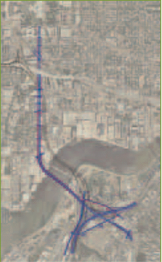
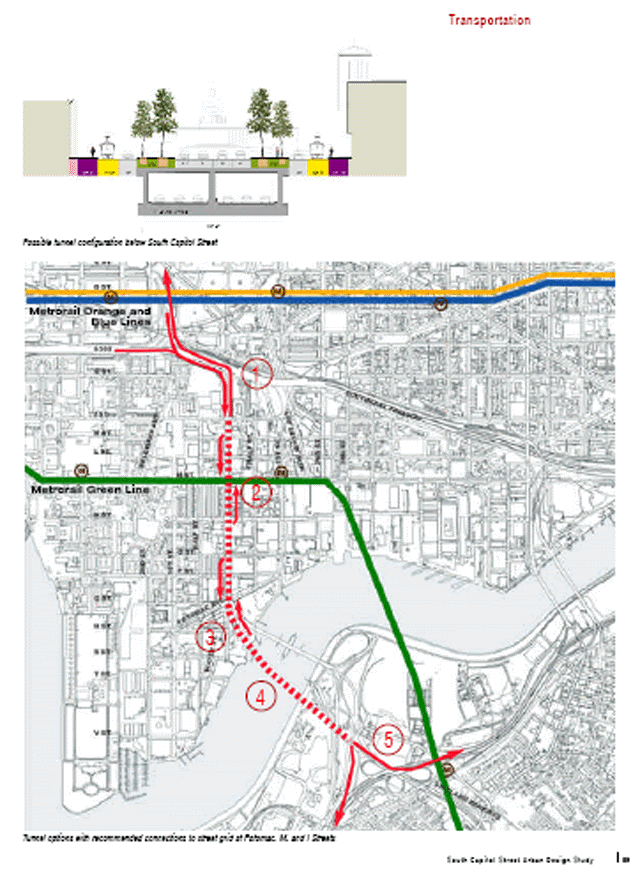
The South Capitol Street corridor tunnel would eventually connect the southern end of the Center Leg southward to resurface south of the River at a reconstructed partially underground interchange with I-295 and the Suitland Parkway. It would initially surface to connect to the existing I-395 SW/SE/Center Leg interchange, before a later project to build the full connections to and with a replacement future underground interchange.

DCDOT
USNCPC

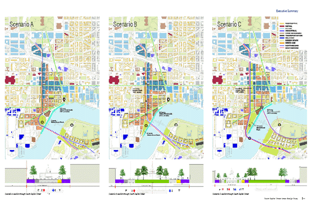
This tunnel appears in the 2002-2003 planning studies for the South Capitol Street Corridor.


It appears with 6 lanes (3 in each direction).

These illustrations are from the 2003 South Capitol Street Urban Design Study (NCPC) and the Urban Gateyway Study (DCOP).

2003 NCPC South Capitol Street Urban Design Study

http://www.ncpc.gov/publications_press/Press_Releases/2003/pr060503_2.html

http://www.ncpc.gov/publications_press/s_cap/part_1.pdf
http://www.ncpc.gov/publications_press/s_cap/part_2.pdf
http://www.ncpc.gov/publications_press/s_cap/part_3.pdf

2003 DCDOP South Capitol Street Gateway Study

http://ddot.dc.gov/ddot/cwp/view,a,1247,q,560731.asp
http://ddot.dc.gov/ddot/frames.asp?doc=/ddot/lib/ddot/information/documents/frames/south_capitol/pdf/sc_cover.pd

USNCPC
Extending the Legacy: Planning America's Capital for the 21st Century

South Capitol Street-Frederick Douglass Mall

The version above with the linear park was for essentially the eastern half of the 1997 Extending the Legacy concept for what would logically be named the South Capitol Street-Frederick Douglass Mall, with the western half being omitted ostensibly to avoid displacing existing residences.


Such a swath of green space would be ideal for crafting an underground freeway, with the space to comfortably accommodate maintaining South Capitol Street traffic throughout the construction.

The 2003 USNCPC South Capitol Street Urban Design Study would proclaim its goal to:

Establish a linear park along the length of a new South Capitol Street that will
connect the Mall and Capitol Hill with the Anacostia River.


Nonetheless both the full and the half Mall proposals have since been precluded by the government's un-reported acquiescence to Roman Catholic Church hierarchy against demolishing or even relocating the St. Vincent de Paul Church at the northeast corner of South Capitol and M Streets (the only building on the northbound side to survive the redevelopment), as well as the placement of Nationals Ballpark Stadium.

This is the South Capitol Street Corridor Tunnel? because of the planning uncertainties of the physical realities that prioritize accelerated real estate development with ZERO consideration of increased construction costs and complexities, including an apparent failure to preserve open space for ramp connections to I-395.


See the series of posts I wrote in 2006 about this tunnel's feasibilities:


http://wwwsouthcapitolstreet.blogspot.com/2006_06_01_wwwsouthcapitolstreet_archive.html

And about the quiet betrayal of the U.S. Capital City's South Capitol Street-Frederick Douglass Mall:

http://wwwsouthcapitolstreet.blogspot.com/2006_03_01_wwwsouthcapitolstreet_archive.html
http://wwwsouthcapitolstreet.blogspot.com/2006_07_01_wwwsouthcapitolstreet_archive.html
http://wwwsouthcapitolstreet.blogspot.com/2006_08_01_wwwsouthcapitolstreet_archive.html
http://wwwsouthcapitolstreet.blogspot.com/

Thursday, March 22, 2007

I-395? New York Avenue Corridor


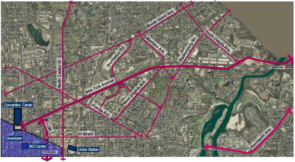
The I-395? New York Avenue Corridor extends from
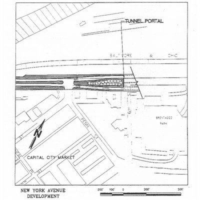
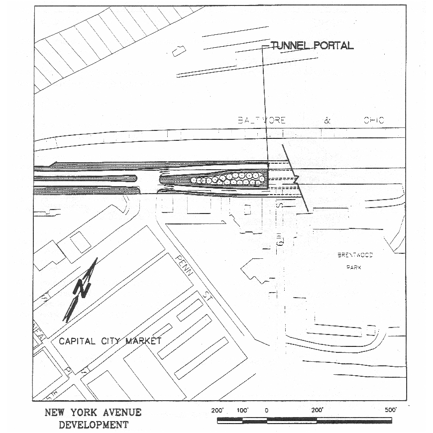
the existing I-395 truncation at 4th Street NW through Washington D,C. NE to the Maryland line, continuing east as the Route 50 (un-signed I-595/Theoretical I-66) freeway. Since the "de-mapping" of the New York Avenue Industrial Freeway, this corridor has come under official re-study. This started with the November 19, 1996 New York Avenue Development Report commissioned by the Office of the D.C. Mayor (then under Mayor Marion Barry). The considerations include possible underground connections to the Washington, D.C. Convention Center to the north of Mt. Vernon Square, and the I-395? New York Avenue Tunnel to connect and presumably continue I-395 easterly beneath that avenue in a cut and cover tunnel extending at least to the vicinity of Florida Avenue. The tunnel would connect I-395 with the general area of interchange "B" that would have connected to northern, eastern and south to west choices.

The recent studies address both this tunnel as well as the New York Avenue corridor further east.

All of the options now officially considered would have the tunnel surface onto a New York Avenue "Boulevard" without connecting to a parallel railroad-industrial highway.

The reluctance of the recent New York Avenue corridor studies to answer the question whether the I-395 designation would be applied make this I-395?

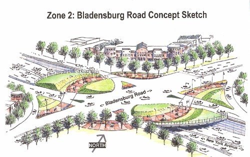
Although these studies fall short in crafting a continuous traffic-light free connection, lest it benefit more people, they include two grade separated options for New York Avenue's intersections with Montana Avenue and with Bladensburg Road: elevated on a berm, or depressed beneath a circular lid that incorporates an SPUI interchange with the lid shape and outer walkways emulating the shape of a classic D.C. traffic circle.


SPUI (Single Point Urban Interchange) with circular lid atop depressed NY Avenue

However, this planning cheaps out by denying this grade separated treatment for Montana Avenue.

Wednesday, March 21, 2007

I-395? New York Avenue Tunnel


1996 D.C. Mayor's Office New York Avenue Revitalization Report

(Ron Linton)

This basic tunnel plan appears in some official planning studies since its introduction of the New York Avenue Development Report of November 19, 1996, commissioned by the the Office of the D.C. Mayor of then D.C. Mayor Marion Barry, who had previously cut his political teeth as part of the anti-highway group ECTC -- the Emergency Committee on the Transportation Crisis -- in the 1960s and 1970s.

This tunnel design is cut and cover beneath New York Avenue.

This takes 0 dwellings, indeed 0 buildings, as opposed to the 600+ of the 1971 design I-95 (I-395) North Leg East.

However it provides a significantly tighter turning radii for the transition to and from the existing I-395 route that would wrap around the west (rear) side of the Bibleway Church complex. All of these recent studies follow this basic design with its tight transition.

This radii would otherwise be avoided for operation ability-safety issues regarding line of sight distances in a curved tunnel.

This proposed tunnel is I-395?, as the studies seem to go out of the way of avoiding answering the question whether it would actually carry the I-395 designation.

Indeed, the study seems afraid to consider constructing this tunnel as part of a continuous freeway- free of traffic lights.

The tunnel is considered in the context of accommodating a new WMATA rail tunnel:


Variants:

Authorities have proposed this tunnel in various lengths.

The 1996 study presented two tunnel length options:

2,100 feet long tunnel with 2 lanes per direction without shoulders and transitioning to surface near Florida Avenue ($340 million)

4,400 foot long tunnel extending to 6th Street NE with 2 lanes per direction with 8 foot right shoulders ($600 million),

A 1998 proposal extended this further east to Montana Avenue NW.

Subsequent studies however have look at a shorter tunnel that ends to the west of Florida Avenue NE, closer to North Capitol Street then the 2,100 foot proposal.

This would then have either a traffic light intersection with, or a raised roadway and bridge over Florida Avenue.

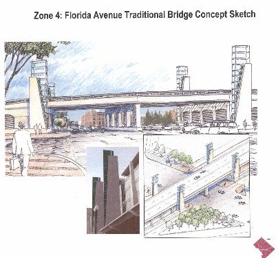
I-395? Overpass at Florida Avenue for post 2000 short tunnel option

From The Washington Post: New York Ave. Traffic Plans Spark Concerns: D.C. Residents React To Draft Proposals; by V. Dion Haynes, Washington Post Staff Writer, Sunday, June 26, 2005; Page C01

Mary Ann Wilmer, 66, who lives near New York Avenue in Northwest Washington, said something must be done to ease rush-hour traffic from I-395. She said it routinely takes her 20 minutes to travel three blocks.

Still, she said in an interview, the overpass "is not very aesthetic. . . . Those concrete barriers sitting up there -- I don't think that will do."

Transportation officials are proposing $1.2 billion worth of projects to ease traffic in a five-mile stretch of the corridor, which often is jammed by a confluence of vehicles from the interstate and neighborhoods. They said the area has nine of the city's most congested intersections, including New York Avenue at Bladensburg Road in Northeast.

"New York Avenue is a very dangerous place. We want to make it safe," Rick Rybeck, the Transportation Department's deputy administrator for transportation policy and planning, told more than 30 residents yesterday at the Frank D. Reeves Municipal Center in Northwest.

Daily, 127,000 vehicles travel on New York Avenue as it crosses the D.C.-Maryland border, the Transportation Department said. Citing population increases and new development, transportation officials predict traffic will worsen.

http://www.washingtonpost.com/wp-dyn/content/article/2005/06/25/AR2005062501097.html

Popular favor for a longer tunnel extending east of the B&O/WMATA Red Line railroad corridor has led to a 2006 D.C. government study of an "extended tunnel" concept that would be almost as long as the initial 1996 long tunnel, but with a grade of 7% grade rather then 5%. This extended tunnel is studied with two variants: one with and one without access ramps between North Capitol Street and Florida Avenue NE.

This variant like all of the others has the tunnel simply surface onto New York Avenue and does not include consideration of having its alignment swing to meet a grade separated I-395 extension along the parallel railroad corridor.

East Portal: 1996 Short Tunnel Option


East Portal: 1996 Long Tunnel Option

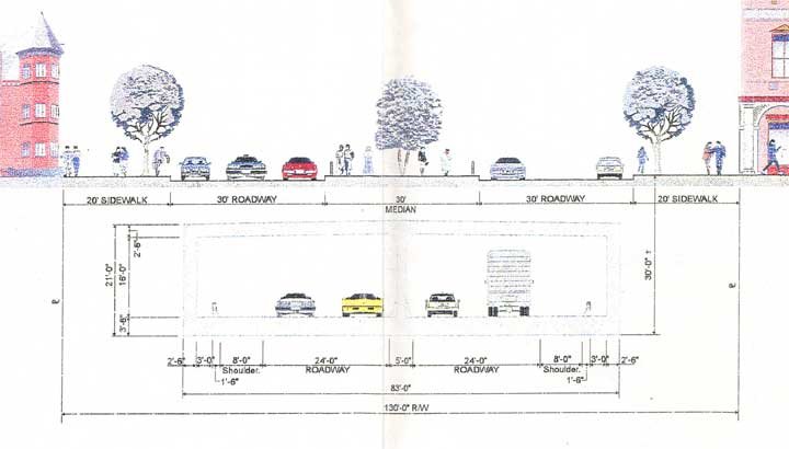
I-395? New York Avenue Tunnel Cross Section

The plan is artificially constrained regarding capacity. New York Avenue is sufficiently wide to fit such a tunnel with up to 7 lanes plus shoulders. (See the illustration above; note that the dimension lines to the left mark this tunnel's wall with three lanes rather then only two).

The existing north-south I-395 accommodates 6-8 lanes, with the tunnel extension between Massachusetts Avenue and K Street having non-load bearing knock-out walls (see the expansion joints on K Street showing this I-395 tunnel's true width in the photo below).

This restriction of only 2 lanes in each direction, whether for the existing, I-395 or for the proposed New York Avenue tunnel saves zero dwellings.
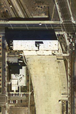
It is further constrained for being considered only as an extension from I-395. Although the 1996 proposal includes a set of tunnel ramps to the west, to an underground connection into the new Convention Center just north of Mt. Vernon Square, it does not include stub connectors to a revived I-66 K Street Tunnel proposal.

Indeed, U.S. National Capital Planning Commission has nothing of the sort in its latest planning regarding K Street. (PDF link)
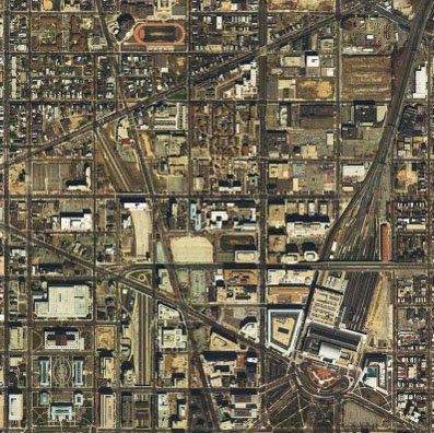

Images produced by National Capital Planning Commission for the Washington Geographic Information System. Distributed by VARGIS LLC of Herndon, VA.

Note the proximity of Washington, D.C.'s I-395 with the two main railroad corridors that both continue into Maryland.

As currently dictated, the project seeks to serve fewer rather then greater numbers of people and goods. It says nothing about time-savings, nor the environmental-footprint benefits of a highway tunnel, while adhering to a dogma against through traffic.

I-395 Tunnel: A Superior Option


Current studies:

http://www.ddot.dc.gov/ddot/cwp/view,a,1247,q,560773.asp

http://www.ddot.dc.gov/ddot/frames.asp?doc=/ddot/lib/ddot/information/studies/newyork/task11memo/extendedtunnel_techmem_2006-07-13.pdf
http://www.ncpc.gov/whats_new/2006/NY%20FLA%20charrette.11.06.pdf