Interchange "B" area
DeLeuw, Cather, with Harry Weese "District of Columbia Interstate System"
November 1971
DeLeuw, Cather, with Harry Weese "District of Columbia Interstate System"
November 1971
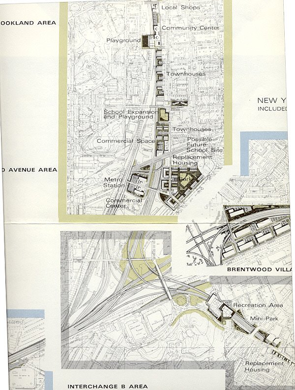
I-95 (today's I-395) and theoretical I-66 North Leg East east of Florida Avenue to interchange "B" with choices to north, east and south:
north: I-95 B&O Route North Central/Northeast Freeway, plus WMATA rail Red Line; see 1966, 1971 and 1973 plans.Both the I-95 B&O Route North Central and the I-295 East Leg are here shown with cut and cover tunnel segments respectively in western Brookland near Catholic University of America (10 lanes, 3/4 mile long displacing and replacing 34 dwellings, and along Mt. Olivet Road NE, (6 lanes,1/2 mile long displacing and replacing 172 dwellings). The Route 50/Theoretical I-66 New York Avenue Industrial Freeway would have displaced 0 dwellings, owing to the available industrial properties, and was not shown with any such lengthier tunneled segments, but only a few short segments.
east: Route 50/theoretical I-66 New York Avenue Industrial Freeway, alas without parallel WMATA rail
south to west: I-295 East Leg of the Inner Loop East Capitol Route to R.F.K. Stadium, looping back to the SE Freeway at the underpasses beneath Barney Circle.


No comments:
Post a Comment