Saturday, January 24, 2009

I-395 Extension

What happens north of New York Avenue?
Today's I-395 3rd Street Tunnel, initially known as the I-95 Center Leg, ends at K Street with a transition road to New York Avenue.

Obviously this highway was intended to extend further.

Planning staring in the mid 1900s shows how this was intended.
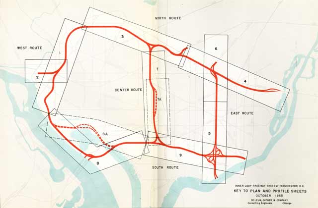
The 1955 Inner Loop study shows this- created from connecting two separate scans.


1955

By the mid 1960s planning looked to a K Street Tunnel as the alternative to the open trench roadway along Florida Avenue and U Street. The following illustrations show the routing evolution.


Early I-66 North Leg West K Street Tunnel proposal From the 1966 North Central Freeway Supplementary Study

I need illustrations of the proposed ramp connections at each end of this early version of he I-66 K Street Tunnel.

1967 Urban League proposal


1971 Center Leg -- North Leg Interchange
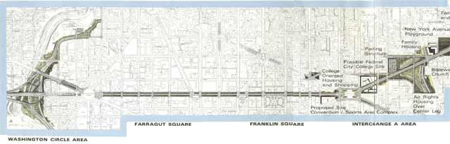

1971 I-66 K Street Tunnel

Initially the I-66 K Street Tunnel would extend all the way to the Center Leg; this was soon changed to having the cross town I-66 tunnel remain beneath K Street to the vicinity of Mt Vernon Square before turning northeasterly to follow the north side of New York Avenue.


1971

This would provide a 10 lane cut and cover along the north side of New York Avenue, intercepting 6 lanes from the 8 lane I-95 Center Leg, and 4 lanes from the I-66 K Street Tunnel. It would provide about a 50 mph design speed through the transition radii. The I-66 tunnel segment from Mt Vernon Square to 4th Street NW would displace 148 dwellings; the I-95 tunnel segment easterly from 4th Street and New Jersey Avenue to 1st Street NE would displace 600+.

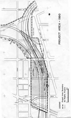


Center Leg with curved connection to North Leg East


1996

This was the first official Washington, D.C. highway proposal since the 1983-1996 planned Barney Circle Connector, presented by the Office of the D.C. Mayor in 1996. It would extend I-395 via a 4 lane tunnel wrapping behind the rear side of the Bible Way and continuing entirely within and beneath the New York Avenue right of way with 0 building displacement, but with a relatively tight transition radii.


2002 - unofficial

I developed this concept of a two deck cut and cover tunnel with 4 lanes per direction with superior operationability geometry of a gentler transition radii, taking advantage of the convenient location of the Dunbar HS with its recreation field to there route a tunnel extending beneath O Street NW-NE to the Florida Avenue area.

This provides a 60 mph design speed, with a 95% reduction of the building displacement of the 1971 design, instead of 600+, it would be some 34 within the lower triangle between 4th, M and N Streets and New Jersey Avenue.


It would be far less disruptive to maintaining traffic during the construction phase then the 1996 design tunnel directly beneath New York Avenue.

Nonetheless it has not been formally considered.

Thursday, January 22, 2009

Tuesday, January 20, 2009

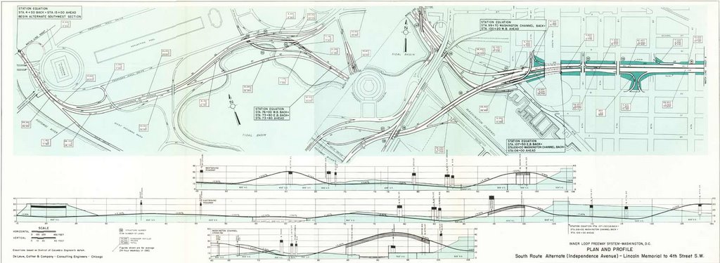
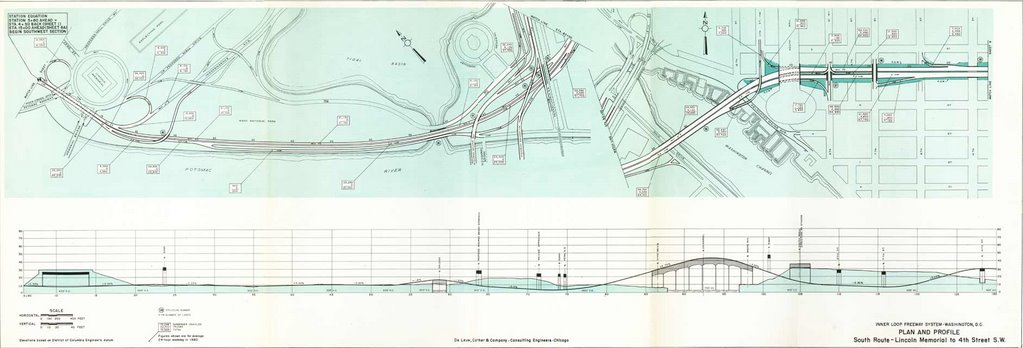
1955 Inner Loop Engineering Study


1955 Inner Loop Freeway Proposal Guide to Plates


Plate 1


Plate 3


Monday, January 12, 2009

Takoma Park Appreciation For Express Road

More or less ...


> ---------- Forwarded message ----------
> From: Kopal Barnouin-Jha <kopalb@gmail. com>
> Date: Thu, Jan 1, 2009 at 4:31 PM
> Subject: sligo creek pkwy closing
> To: takoma@yahoogroups. com
>
>
> Hi all,
>
> I've been trying to figure out (from the mayor, my ward rep and
> through the PWD) why Sligo Creek Pkwy is closed between Maple and Old
> Carroll. It's totally fine, to the somewhat-trained eye, and having
> walked it routinely, know that nothing has gone on in the few months
> that it's been closed off.
>
> Not only is it hugely inconvenient, it's also dangerous (traffic has
> to go through that stretch via other smaller roads that are not set up
> for that kind of traffic, and Lincoln, in particular, has terrible
> visibility when it comes to crossing over Carroll.)
>
> Who can tell me:
>
> - why is it closed?
> - when it will open?
>
> If no one can, who should I ask - suggestions welcome.
>
> Thanks,
>
> Kopal
>
> --
> Dr. Kopal Barnouin-Jha
> kopalb@gmail. com
> www.ecologyfund. com
> www.greyhoundwelfar e.org
>

Friday, January 09, 2009

Obaminaugeration Changes Attitudes on D.C. Radial Freeways?

Bridges from, and particularly the inside the Beltway radial freeway closures within Virginia, on Barack Obama's inauguration, reveal attitudes of disconnect from the denial of freeways into Washington, D.C. from Maryland.

As found at Sam Smith's:
GRIDLOCK WE CAN COUNT ON

Dorothy Brazil, DC Watch - The Secret Service released its plans for street closings in DC on inauguration day, January 20, and they're wildly disproportionate to any past inaugural closing plans. They're not just meant to clear the area around the Capitol ceremony and the Pennsylvania Avenue parade, as they always have been in the past. Instead, they're designed to paralyze the city as a whole and to overburden Metro so much that it will be unusable on that day. Not only will three and a half square miles of downtown DC be closed to car traffic, but, in addition, all bridges and major roads linking the District to northern Virginia will be closed to vehicular traffic. These plans will inconvenience DC residents and workers, and they'll make it difficult for all the visitors to DC to get to the inaugural events they came to see. As these plans have been made by the Secret Service and the Obama Presidential Inauguration Committee over the past few weeks, it has become increasingly clear that neither group cares in the least about accommodating DC residents, commuters, and visitors. It has also become clear that neither Mayor Fenty nor any DC government representative has played an independent role as a spokesman for our interests, and that nobody representing the city has tried to introduce common sense into the overblown, grandiose "security" schemes that will shut down our city unnecessarily.

Washington Times - The Secret Service announced unprecedented security measures for the presidential inauguration, saying it will shut down all bridge crossings from Virginia into the District and establish a security perimeter that closes or limits vehicular access on 100 city streets. AAA Mid-Atlantic spokesman John B. Townsend II predicted the bridge closings will overburden entry points to the city through Maryland and create gridlock throughout the metropolitan area.

"It's overkill," he said. "It totally cuts off access from Virginia. This is the most ridiculous thing I've heard of in my life. It just doesn't make sense.". .
On January 20, 2009, the date of Barack Obama's inauguration, the bridges into Washington, D.C. from Virginia and the radial freeways within the Beltway in Virginia will be closed, and critics of this fail to see the similarities to the same regarding the lack of radial freeways from Maryland!

One can enter Washington, D.C. from Virginia by diverting to the Capital Beltway and entering from the Maryland side of the Potomac, via I-295 from the south, Route 50 from the east, or any of the surface streets: a situation decried by those that say nothing, or have actively opposed any radial freeways in the entire within D.C. arc from the Potomac River clock-wise to Route 50!

As a scholar of the planning of the Washington, D.C. freeways who was part of the panel Freeways in Washington (a review by Mark Bentley) at the 1998 annual conference of the D.C. Historical Society, and did a presentation on behalf of NE D.C. Historical Society in 2005, who has perused numerous documents at the D.C. Martin Luther King Public Library Washingtonia Division, as well as at the George Washington University Gelman Library Special Collections, my recollection is that Sam Smith took a strongly derisive attitude towards the North Central Freeway, including its far less intrusive 1971 design.

And So Does The U.S. National Capital Planning Commission


A Sampling Of Attitudes Towards D.C. I-95

North Central Freeway Routing Mystery

See the tag "Highway Routing Mysteries"

Sunday, December 28, 2008

Who Really Stopped Washington, D.C.'s Freeways

From Zachary Schrag
http://www.washingtonpost.com/wp-srv/liveonline/00/magazine/levey112700.htm

Washington, D.C.: I enjoyed the article, especially the profiles of Booker and Abbott. But let's not forget who really stopped Natcher's attempt to force the city to accept the freeways.

While the ECTC was gathering a few dozen people to march on picket lines and disrupt hearings, Congressman Robert Giaimo of Connecticut was gathering votes in the House of Representatives to release subway funds from Natcher's control. Thanks to his efforts, on Dec. 2, 1971, the full House voted 195 to 174 to release the D.C. share of Metro funds without forcing the city to build the Three Sisters Bridge. Following this defeat, a very rare case of the full House overruling an appropriations subcommittee chairman, Natcher never again seriously threatened Metro. And without that threat, the D.C. government had no reason to build the freeways.

Essentially there were three challenges to the freeways: in the streets by the ECTC, in the courts by Peter Craig (and his pro bono counsel, Roberts Owen), and in Congress by Robert Giaimo. Craig and Owen bought time, and Giaimo stopped Congress's blackmail. The ECTC, however noisy, did relatively little to change the minds of people in power. Radical protest can make a difference, but in this case the real victory was won by people working within the system.

Zachary Schrag
Columbia University


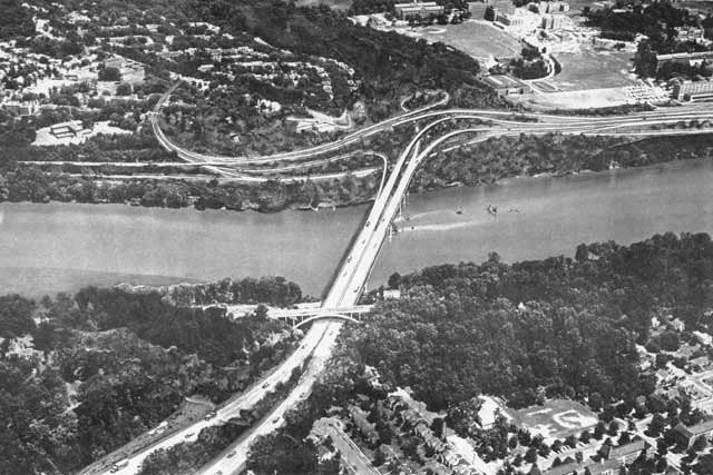
Proposed I-266 Three Sisters Bridge
looking from Virginia to Washington, D.C.
with Georgetown University at upper right.


... Peter Craig, a junior lawyer at the prestigious firm of Covington & Burling. Craig had come to Washington after graduating from Yale Law School in 1953.

In September 1966, following the N.C.P.C. vote, the Committee of 100 resolved to file a law lawsuit against the D.C. government and the N.C.P.C. to block [3 Sisters] bridge construction. Peter Craig, acting for the committee, turned to his former law firm, Covington & Burling. Partner Gerhard Gesell agreed to take the case for a nominal retainer and assigned lawyers Roberts Owen and Gerald Norton to the matter. Owen, the lead counsel, had paid little attention to the highway fight, but he enjoyed suing the government to force it to obey the law.

p 41 and 125 The Great Society Subway by Zachary M. Schrag


   Proposed I-95 B&O North Central Freeway next to Catholic University of America


Covington & Burling


Read About the Committee of 100's opposition to US NCPC's Extending the Legacy

Committee of 100 Ruminations


Frederic Delano 'Family' : U.S. NCPC, Committee of 100, and Covington & Burling


Subverting the North Central Freeway

Physical Realities Undermining the North Central Freeway

A Sampling Of Attitudes Towards D.C. I-95

Wednesday, December 17, 2008

Under Selling The B&O Metropolitan Branch

From Richard Layman:

UnderSelling by not mentioning the potential linear park, let alone render that corridor to be more multi-model with an underground North Central Freeway
http://urbanplacesandspaces.blogspot.com/2008/12/transportation-infrastructure-plan-for.html

Crazy Hard and Expensive Proposal

12. If you really want to spend money on infrastructure....

a. put the CSX Metropolitan Branch railroad underground.
b. There would have to be at least two levels of tunnel, for both the railroad -- three tracks -- and for the subway.
c. Make the subway tunnel two levels, or capable of carrying doublestack trains to double the capacity of the red line subway.

This one is so expensive that I won't put it in the priority list, but it could be done and would impact the region's and especially the city's competitive advantage for generations. See the blog entry, "Rethinking the Metropolitan branch railroad and subway tracks in northeast DC" for much more about this.
I have cut and pasted that below:
Rethinking the Metropolitan branch railroad and subway tracks in northeast DC

1. I find it interesting that last week's Current Newspapers announced in an editorial that Mayor Fenty has ordered a cessation of planning to remove the Whitehurst Freeway, something opposed by some but not all of the citizens groups in the Greater Georgetown neighborhood.

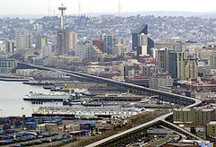
2. This is counter to the trend across the country, such as in San Francisco and Milwaukee, not to mention cities like Seoul, where this has already been done. Seattle probably will remove the Alaskan Way Viaduct as well (and there is no question that the Viaduct there cuts off the city from the water).
Seattle's 2-mile-long Alaskan Way Viaduct
AP photo: Seattle's 2-mile-long Alaskan Way Viaduct.

See "15 SECONDS THAT CHANGED SAN FRANCISCO / The sweeping makeover that transformed the city began 15 years ago today with the Loma Prieta earthquake," by John King from the San Francisco Chronicle about removal of the Embarcadero Freeway and the subsequent positive impact.

Also see "Freeway Deconstruction and Urban Regeneration in the United States," a paper from the University of California Transportation Institute and the webpage "Removing Freeways, Restoring Cities."

3. At the Congress for the New Urbanism meeting in Philadelphia there was a session on removing freeways along riverfronts. Michael Lewyn has some notes about the session in his blog. From the entry:

Jeff Tumlin asserted that freeways export real estate value from cities to suburbs; their absence maximizes cities' property value. He used Vancouver as an example of life without freeways: while downtown vehicle trips increased in every other Canadian city since 1995, such trips decreased in Vancouver- even while total trips (including walking/transit/bike trips) increased by 22%!

4. Plus, the City is removing part of the Frederick Douglass Bridge on South Capitol Street, putting more of the roadway at grade, and restoring the street grid in that area. See "Dead End at the Anacostia," subtitled "Two-Month Project Will Complicate Life for 77,000 Douglass Bridge Commuters" from the Washington Post, and ignore the focus on the very short term inconvenience to commuters. Instead focus on how the area will be improved by the reduction of the amount of aerial freeway span and the restoration of the grid.

From the article:

The bridge repairs are being done to extend the life of the span until a new bridge is built. The $27 million project also will allow the new bridge to be built and connected to the street grid without major interruptions, officials said.

About 400 feet of bridge will be eliminated on the northern side of the crossing and 200 feet will be lowered about 10 feet so the span touches down at Potomac Avenue. As part of the project, the stretch of South Capitol Street just north of the bridge will become a tree-lined boulevard.

Click here for the complete Washington Post graphic about the South Capitol Bridge project.

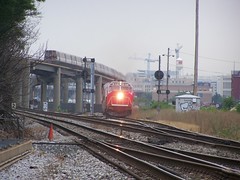
MARC train and subway at Rhode Island Avenue Station

MARC train and subway at Rhode Island Avenue Station

5. In the context of the current underway Brookland Small Area Plan, some of the residents have come up with an alternative suggesting that the railroad and subway tracks and subway station be "depressed" or decked, and the street grid be restored in the area between the two railroad bridge overpasses at Monroe and Michigan Avenues.

(In a conversation last night with a colleague he mentioned that it is not possible from an engineering to depress the railroad tracks for that depth for such a short distance. Railroad locomotive engines like even grades.)
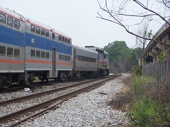
MARC train north of Rhode Island Avenue Station
MARC train north of the Rhode Island Avenue Subway Station

But after reading the piece about the re-configuring of the South Capitol Street bridge, to remove one span and put the street back in and on the grid, I have been thinking that it doesn't reach far enough. The Brookland "alternative proposal" doesn't suggest extending this idea and removing the bridges.
Looking at the Michigan Avenue Bridge, Brookland

Monroe Street bridge, Brookland

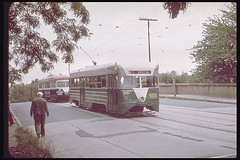
Monroe Street bridge and the streetcar
Monroe Street bridge and the streetcar, Joe Testagrose Collection.

6. Extending this idea further, like the Reno Retrac project or the creation of the Alameda Transportation Corridor to connect the Ports of Long Beach and Los Angeles, how about putting the railroad tracks and subway tracks and subway stations below grade, from the Rhode Island Metro Station to perhaps as far as the Silver Spring Metro Station? Definitely to Takoma.
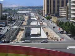
Reno Retrac project
Reno Retrack project. Image by JBR Environmental Consultants.

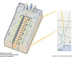
Alameda Transportation Corridor
Mid-corridor tunnel, Alameda Transportation Corridor.

Both the Reno and Alameda Corridor projects created ditches. (See "The Train Line" for more about the LA project, and the City of Reno website on the Retrac project, including a section on the history of the project.) Instead, I suggest creating the ditch and covering it over, and restoring the street grid.

At Rhode Island Station, the subway tracks are high high above the street, but starting somewhat south, around the big Post Office Complex off Brentwood Road, the tracks could begin to go underground, instead of climbing up very very high. (The tracks start rising just south of the equivalent of T Street NE, around the WMATA maintenance facility.)
Subway bridges over Rhode Island Avenue NE, looking west

Corner of T and 5th Streets NE, adjacent to Sanitary Grocery, near the beginning of the rise of the subway track bridge

Around Franklin Street NE, the tracks go back to grade and a little further they even go underground a bit, where one of the railroad tracks cuts over to the east, and from that point going north for a ways, the railroad tracks bracket the red line subway tracks. Metro tunnel heading north to Brookland around Girard Street at 9th Street NE
Metro tunnel heading north to Brookland around Girard Street at 9th Street NE.

At the very least, it could be done in Brookland, say from Franklin Street up to Ft. Totten. By Franklin the tracks come down to grade or below anyway, from very high up at Rhode Island Station.
Lawrence Street stub at 9th Street NE

Lawrence Street stub at 9th Street NE

7. Another example would be the proposal for a Tysons Corner tunnel, which proposed a two level tunnel, using Spanish technology.
Tysons Tunnel diagram
This idea could be further extended, and a two tunnel system could be created to separate the railroad from the subway.


See this blog's articles on the Grand Arc Mall Tunnel