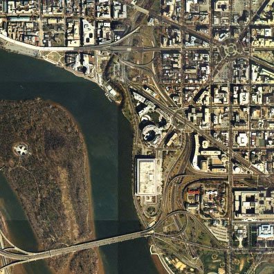
 I-66 West Leg
with Theodore Roosevelt Bridge at left,
E Street Expressway at right,
and Whitehurst Freeway at upper left
Image produced by National Capital Planning Commission for the Washington Geographic Information System. Distributed by VARGIS LLC of Herndon, VA.
The I-66 West Leg is that section of stranded freeway in Washington, D.C. that connects with the Constitution Avenue/Theodore Roosevelt Bridge, and runs roughly north-south past the J.F.K.Center for the Performing Arts and the Watergate complex, to end at its interchange with the Whitehurst Freeway and K Street, where its construction was segmented largely due to the planning uncertainties over the I-66 continuation and the I-266 project.
1955 Design: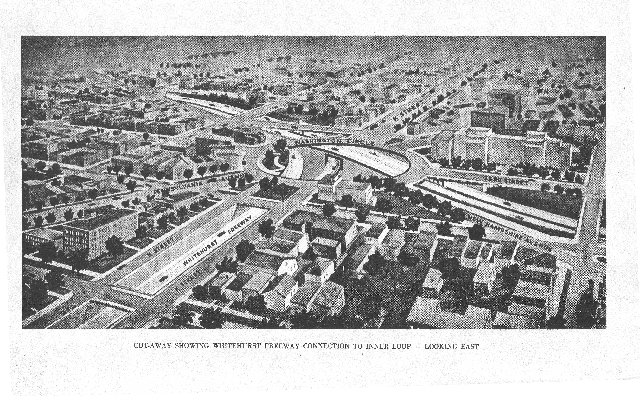 This may be seen at plates 1 and 2 at 1955-62 Plans. This included an underground interchange beneath Washington Circle connecting to the Whitehurst Freeway.
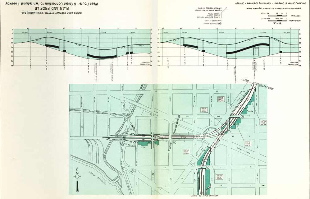
Plate 3 with the Whitehurst-West Leg underground interchange beneath Washington Circle

1957 Design:

The 1957 North West Freeway study "A Report of the study on the location of Interstate U.S. Route 240 Washington, D.C. June 1957" included a revision to the West Leg route that eliminated the underground interchange beneath Washington Circle, replacing it with an exposed interchange to the west, and with a due north-south route. I need a scan of that plan.
Subsequent Design:
The West Leg underwent at least a third design, as indicated by the curved route adopted for the project that underwent construction around 1963. I have not found anything on the story behind this curve which appears to exist primarily to bend this highway to avoid the building that now houses the Embassy of Saudi Arabia.


No comments:
Post a Comment