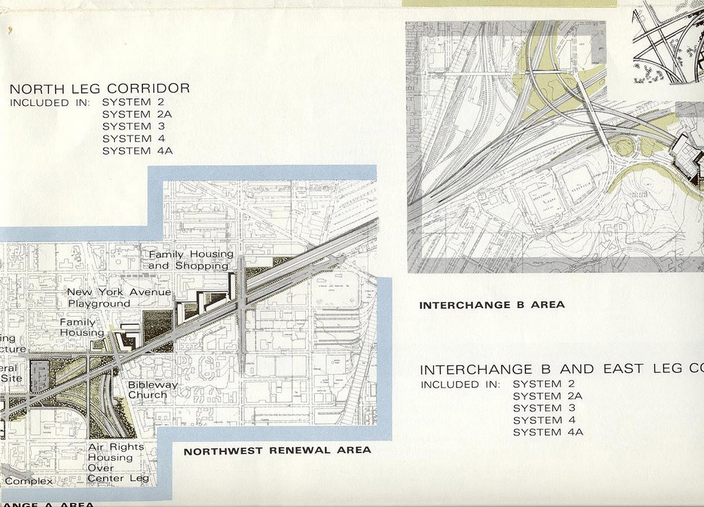
with tunnel west from North Capitol Street
DeLeuw, Cather, with Harry Weese "District of Columbia Interstate System" November 1971
The segment along the north side of New York Avenue between 4th Street NW and North Capitol Street, plus a one block row to the east that has been since demolished, would have displaced -- and replaced -- about 600 dwellings, which form the architectural vanguard Victorian Washington, D.C. neighborhoods.
The design shows the I-95 North Leg East as a cut and cover tunnel with its portal just east of North Capitol Street, transitioning to an elevated configuration to overpass Florida Avenue NE.and the B&O railroad to meet interchange "B".
As with the other un-built Inner Loop segments, such as the I-66 North Leg West, the I-95 (I-395) North Leg East underwent radical routing and design changes to reduce its impacts, such as dwelling displacement.
The design featured in the 1955 Inner Loop had a Center Leg that extended blocks due north of New York Avenue, to an upside down “T” interchange to the north of P Street with a depressed I-66 to the west and an elevated I-95 to the east. See plate 3 at 1955-62 Plans.

Isometric looking north at I-66/I-95 underground interchange from DeLeuw, Cather, with Harry Weese "District of Columbia Interstate System" November 1971
The North Leg East Tunnel concept came with the radical design and routing changes to other such un-built Inner Loop segments, most notably the I-66 North Leg West. The replacement with the 1955 Inner Loop Freeway proposal placing an open trench cross town I-66 along Florida Avenue and U Streets NW, with the I-66 K Street Tunnel concept, and the subsequent refinement of the latter with an eastern approach to the east of Mt Vernon Square as a tunnel beneath and along New York Avenue for the North Leg West, lead to a similarly radical change to the North Leg East, particularly with making it a tunnel at least as far east as North Capitol Street.
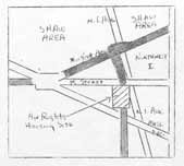
The earliest proposal for a North Leg East Tunnel that I am aware of is that from the 1967 Urban League Neighborhood Advisory Council. It placed the North Leg to the east of
1) The need to avoid the Carnegie Library foundations. The design as evolved by 1971 had the I-66 tunnel do that by swinging to the north, and hence pushing the route largely under
2) The fact that

The 1971 plan addresses this by placing the I-95 North Leg East Tunnel entirely to the north of
This would more easily allow
It would provide something on the order of a 50 mph design speed for the curved transition to and from the Center Leg.

But, for an overall un-built freeway system that had its dwelling displacement reduced by perhaps 90%, it would remove the 600+ Victorian dwellings in this new swath between New Jersey Avenue and North Capitol Street (plus a few to the east that were later torn down under the administration of D.C. Mayor Anthony Williams). The 1971 study would show these replaced with new dwellings, perhaps with a greater number. Today these dwellings are largely intact, and are what could be called the vanguard of D.C.’s historic neighborhoods that greets visitors from the east.
It is also the segment essential for connecting un-built I-66 and built I-95 (I-395) to the north-east, with a relatively short residential area to transverse to reach the open lands to the east of
Hence it was the last Inner Loop segment to be “de-mapped” around 1978-1981, after the East Leg and the earlier cancellation of the North Leg West. Although the Center Leg extension – the tunnel from
 1996 D.C. Mayor's Office New York Avenue Revitalization Report (Ron Linton)
And it has been the only canceled Inner Loop segment (other then the approach to the
This takes 0 dwellings, indeed 0 buildings, as opposed to the 600+ of the 1971 design.
However it provides a significantly tighter turning radii for the transition to and from the existing I-395 route that would wrap around the west (rear) side of the
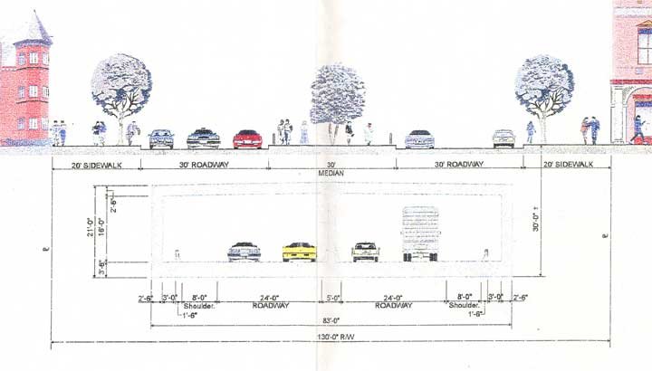 The plan is artificially constrained regarding capacity. Although New York Avenue is sufficiently wide to build such a tunnel with as much as 3 lanes in one direction and 4 in the other direction, and with the existing I-395 Center Leg designed with 4 lanes per direction, with non-load bearing knock-out walls, this proposal only presents this tunnel with two lanes per direction. This reduction in capacity saves 0 dwellings.
It is further constrained for being considered only as an extension from I-395. Although the 1996 proposal includes a set of tunnel ramps to the west, to an underground connection into the new Convention Center just north of

2,100 feet long tunnel with 2 lanes per direction without shoulders and transitioning to surface between North Capital Street and Florida Avenue ($340 million)
4,400 foot long tunnel extending to 6th Street NE with 2 lanes per direction with 8 foot right shoulders ($600 million),
Subsequent D.C. government studies look at a shorter tunnel that ends to the west of Florida Avenue, where there would either be a traffic light intersection or a raised roadway and bridge. Popular favor for a longer tunnel has led to a D.C. government study of one that would be almost as long as the initial 1996 long tunnel, but with a grade of 7% grade rather then 5%. This study simply as the tunnel surface onto New York Avenue and do not include consideration of having its alignment swing to meet a grade separated I-395 extension along the New York Avenue Industrial corridor along the railroad, perhaps partially beneath a cantilevered lid.
 Image produced by National Capital Planning Commission for the Washington Geographic Information System. Distributed by VARGIS LLC of Herndon, VA.


No comments:
Post a Comment